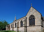
Benton, Tyne and Wear
AC with 0 elementsDistricts of Newcastle upon TyneMetropolitan Borough of North TynesideTyne and Wear geography stubsUse British English from July 2015
Benton is a district 4 miles (6 km) to the north east of Newcastle upon Tyne. A section of this district is administratively part of the city, but the greater part, which lies inside the Parish of St Bartholomew, Longbenton, is within North Tyneside. The population of the North Tyneside Ward taken at the Census 2011 was 10,359.
Excerpt from the Wikipedia article Benton, Tyne and Wear (License: CC BY-SA 3.0, Authors).Benton, Tyne and Wear
Charnwood Avenue, North Tyneside Benton
Geographical coordinates (GPS) Address Nearby Places Show on map
Geographical coordinates (GPS)
| Latitude | Longitude |
|---|---|
| N 55.014 ° | E -1.587 ° |
Address
Charnwood Avenue
Charnwood Avenue
NE12 8SL North Tyneside, Benton
England, United Kingdom
Open on Google Maps


