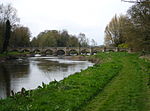
Way for the Millennium
Footpaths in StaffordshireGeographic coordinate listsLists of coordinatesLong-distance footpaths in EnglandNewport, Shropshire ... and 2 more
Staffordshire geography stubsUse British English from April 2017

The Way for the Millennium is a 41-mile-long (66 km) east–west route across Staffordshire, deliberately designed for easy walking, using towpaths, old railway lines and footpaths and visiting attractive countryside and green spaces.
Excerpt from the Wikipedia article Way for the Millennium (License: CC BY-SA 3.0, Authors, Images).Way for the Millennium
Tixall Road,
Geographical coordinates (GPS) Address Nearby Places Show on map
Geographical coordinates (GPS)
| Latitude | Longitude |
|---|---|
| N 52.8025 ° | E -2.0237 ° |
Address
Tixall Road
Tixall Road
ST18 0XN
England, United Kingdom
Open on Google Maps


