place

Bournemouth Gardens, England

1830s establishments in EnglandEnglish gardens in English Landscape Garden styleGardens in DorsetGrade II listed garden and park buildingsGrade II listed parks and gardens in Dorset
Tourist attractions in Bournemouth
Bournemouth The Upper Gardens (NBY 441930)

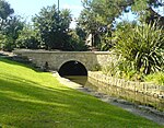
Bournemouth Gardens are Grade II listed gardens in the town of Bournemouth, Dorset, England. Created in the nineteenth century, the gardens follow the towns eponymous River Bourne three kilometres from the historic boundary with Poole south-eastwards into Bournemouth Town Centre. The Gardens are home to a number of significant Bournemouth landmarks and listed buildings such as; the Town Hall, the War Memorial, St. Andrew's Church and the Pavilion Theatre. Bournemouth Gardens have been Green Flag Award winners since 1999.

Excerpt from the Wikipedia article Bournemouth Gardens, England (License: CC BY-SA 3.0, Authors, Images).

Bournemouth Gardens, England
Pier Approach,

Geographical coordinates (GPS) Address Nearby Places
placeShow on map

Wikipedia: Bournemouth Gardens, EnglandContinue reading on Wikipedia

Geographical coordinates (GPS)

Latitude Longitude
N 50.717369444444 ° E -1.8758333333333 °
placeShow on map

Address

Pier Approach
BH2 5AA , West Cliff
England, United Kingdom
mapOpen on Google Maps

Bournemouth The Upper Gardens (NBY 441930)
Share experience

Nearby Places

River Bourne, Dorset

The River Bourne is a small river in Dorset, England. It flows into the English Channel at Bournemouth, taking its name simply from Middle English bourn or burn, a small stream, and giving it to the town at its mouth.The Bourne comprises two main tributaries totalling just over 13 kilometres (8.1 mi) of waterway; of this total length 5.7 kilometres (3.5 mi) is culverted and 7.5 kilometres (4.7 mi) is open stream. Its drainage catchment is some 14 square kilometres (5.4 sq mi), about 70% of which lies within the Borough of Poole.The stream is fed from a number of sources but there is little documentary evidence and the actual origins of some are unknown. The head of the stream consists of three culverts emerging from below Ringwood Road; it is believed that one drains Canford Heath, one is fed from the Bournemouth and West Hampshire Water works at Francis Avenue in Knighton Heath and the third is supplied by road run-off. After flowing across Alderney Recreation Ground the stream is culverted for 2.4 kilometres (1.5 mi) and re-emerges at Coy Pond Gardens. The stream is also fed by natural seeps and flushes, and there are 62 documented surface water discharges to the watercourse.In the upper reaches, the catchment boundaries are approximately defined by Ringwood Road to the west, Wallisdown Road to the north and Ashley Road/Poole Road to the south. In the lower reaches, the catchment width gradually narrows towards the outfall at Bournemouth Pier. The overall fall between the highest levels in the upper catchment to the Poole Bay outfall is approximately 60 metres (200 ft), giving an overall gradient of approximately 1:100 which is considered to be steep. Reaching Bournemouth Town Centre, it flows through public gardens, known as the Upper, Central and Lower Gardens. It goes underground at The Square (which divides the Central Gardens from the Lower Gardens) and again just before it reaches the beach immediately east of Bournemouth Pier. The stream no longer flows directly into the sea under normal conditions, it instead flows into the combined storm overflow beneath the Pier Approach flyover. During periods of exceptionally high flow, the stream flows over the top of a weir into a concrete culvert, the outlet of which lies just east of Bournemouth Pier.

Bournemouth
Bournemouth

Bournemouth ( BORN-məth) is a coastal resort town on the south coast in the Bournemouth, Christchurch and Poole unitary authority area in the ceremonial county of Dorset, England. The town's urban subdivision had a population of 187,503 at the 2011 census making it the largest town in the county; the town is part of the South East Dorset conurbation, which has a population of 465,000. Founded in 1810 by Lewis Tregonwell, in an area of deserted heathland occasionally visited by fishermen and smugglers, as a health resort, Bournemouth became a town in 1870, with growth from the arrival of the railway. Bournemouth lies in the historic county of Hampshire. Following the local government reorganisation in 1974 the town was transferred to the county of Dorset, governed by Dorset County Council. Although the borough gained unitary authority in 1997, it retained Dorset's ceremonial county functions and emergency services. In April 2019, the borough was replaced by the current borough, also with unitary authority status, governing the town, Poole, Christchurch and surrounding areas. Victorian architecture is notable in town centre. The 202-foot (62 m) spire of St Peter's Church, one of three Grade I listed churches in the borough, is a local landmark. The town's location has made it a popular destination for tourists, attracting over five million visitors annually with its beaches and popular nightlife. It is also a regional centre of business, home of the Bournemouth International Centre (BIC) and a financial sector that is worth more than £1 billion in gross value added.