Desierto de los Leones National Park

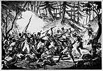
Desierto de los Leones (Desert of the Lions) National Park is located entirely within the limits of the Federal District; it stretches between Cuajimalpa and Álvaro Obregón boroughs. It is located in the Sierra de las Cruces mountain range west of the city center with an area of 1,867 hectares, representing fifteen percent of the entire Valley of Mexico. The term Desierto (‘desert’) is used in this context in the archaic sense of “wild, sparsely populated area” rather than in reference to an arid environment. Leones (‘Lions’) refers not to the big cats but rather to the original landlord's surname.The park's altitude varies between 2,600 and 3,700 meters above sea level, giving the area a relatively cold and damp climate. It is a forested area primarily with pines, oyamel firs and oaks with many brooks, ravines and waterfalls. The park is considered to be the oldest protected biosphere in Mexico. It was originally declared a forest reserve in 1876 by President Lerdo de Tejada with the intent of conserving its fresh water springs to supply Mexico City. It was later declared a national park on 27 November 1917, by President Venustiano Carranza.
Excerpt from the Wikipedia article Desierto de los Leones National Park (License: CC BY-SA 3.0, Authors, Images).Desierto de los Leones National Park
Sendero de los Hermanos Descalzos, Santa Fe Cuajimalpa de Morelos
Geographical coordinates (GPS) Address Nearby Places Show on map
 Continue reading on Wikipedia
 Geographical coordinates (GPS)
| Latitude | Longitude |
|---|---|
| N 19.31264 ° | E -99.30628 ° |
Address
Sendero de los Hermanos Descalzos
Sendero de los Hermanos Descalzos
05740 Santa Fe, Cuajimalpa de Morelos
Mexico
Open on Google Maps