place

Rancho Bravo Tacos

2002 establishments in Washington (state)Capitol Hill, SeattleFood trucksKent, WashingtonMexican restaurants in Seattle
Restaurants established in 2022University District, SeattleUse mdy dates from November 2022Wallingford, Seattle
Rancho Bravo Tacos, Capitol Hill, Seattle, 2022

Rancho Bravo Tacos is a small chain of Mexican restaurants in Seattle, in the U.S. state of Washington. Owner Freddy Rivas started the business as a food truck in Kent in 2002, before relocating to Wallingford in 2007. The business also operated restaurants on Capitol Hill and in the University District. Serving cuisine such as tacos, nachos, burritos, tamales, and tortas, the business has garnered a generally positive reception as an inexpensive and late night option for diners, with the tacos and burritos receiving the most praise.

Excerpt from the Wikipedia article Rancho Bravo Tacos (License: CC BY-SA 3.0, Authors, Images).

Rancho Bravo Tacos
Northeast 45th Street, Seattle Wallingford

Geographical coordinates (GPS) Address Nearby Places
placeShow on map

Wikipedia: Rancho Bravo TacosContinue reading on Wikipedia

Geographical coordinates (GPS)

Latitude Longitude
N 47.6612 ° E -122.32643 °
placeShow on map

Address

Rancho Bravo Tacos

Northeast 45th Street 211
98105 Seattle, Wallingford
Washington, United States
mapOpen on Google Maps

Rancho Bravo Tacos, Capitol Hill, Seattle, 2022
Share experience

Nearby Places

Home of the Good Shepherd

Meridian Playground (also known as Meridian Park) is in the Wallingford neighborhood of Seattle, Washington, United States. The site features a building called the Good Shepherd Center, which is listed on the National Register of Historic Places as the Home of the Good Shepherd and is a city of Seattle designated landmark. The center was built in 1906 as a Catholic School for wayward girls and operated until 1973. The building is now run by Historic Seattle, while the remainder of the site is run by Seattle Parks and Recreation.The building includes space for the Wallingford Community Senior Center, Meridian School, Seattle Tilth, community organizations, and low cost housing for artists. The old chapel in the center of the top two floors has been converted into a performance space that features experimental performances organized through the Wayward Music Series.The gardens and the apple orchard of the old school largely remain, but the pool has been filled in and the bath house has been converted into a picnic shelter. Amid the orchard are a playground and two playfields, and to the south side is a P-Patch operated by Seattle Tilth. Community involvement with the site occurs through the Good Shepherd Center Advisory Board.The playground at the site was revamped in 1998 and then upgraded in 2007, both times with matching grants through the city. The sculptures at the back of the playground are based on children's book characters and the two sculptures at the entry are designed to recall past use of the Home of the Good Shepherd, with a nun in front of the GSC and a school girl picking an apple. There is also a niche sculpture of Jesus as the Good Shepherd over the front entrance to the Center. The play equipment includes a water run (now shut down), swings, and some spinning Kompan play structures for older children.

Meridian, Seattle
Meridian, Seattle

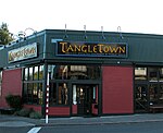
Meridian or Tangletown is the part of Seattle's Wallingford neighborhood that lies north of N 50th Street, near Green Lake. Of note are its "K streets": Kensington, Kenwood, Keystone, and Kirkwood Places N.The concentration of mostly retail businesses on N 55th Street near Meridian Avenue is known variously as Tangletown or Meridian and considered by some to be more closely associated with Greenlake than Wallingford. The likely source for the name Tangletown is the irregular configuration of Seattle' s street grid in this transition zone, where Wallingford shades into the Green Lake neighborhood, some of which follow the contours of Green Lake, others conforming to the city's basic grid. An alternative explanation is that the neighborhood was given the name Tangletown years ago, when a streetcar interchange occupied the space where businesses and condominiums now stand. Meridian sometimes refers to a wider neighborhood than Tangletown, which refers strictly to the retail district. The name Meridian came from the Meridian Line, a streetcar line. The name became popular when it was used by brothers Stan and Milton Stapp who published the local newspaper, the North Central Outlook. They used the term to differentiate the area from the nearby neighborhoods of Greenlake and Wallingford.One of the neighborhood's principal landmarks The Keystone Building, built in 1910 by D.J. Orner & Son (see image below) has been the home of various businesses over the years. In 1938, the building housed the Barclay's Grocery, Kenwood Market and Sires Brother's Paint Company. From 1956 it became the longstanding Lamont's Food Center until the 1980s when it was converted to the Honey Bear Bakery, while the East side of the building became the M&R Grocer. Today the West corner of the building is home to the TangleTown Public House (the old Honeybear bakery) while the East side is now the Mighty-O Donuts headquarters. The neighborhood is bounded on the south by N 50th Street, beyond which is the rest of Wallingford; on the west by Green Lake Way N., beyond which is Woodland Park and Phinney Ridge; on the north by N 60th Street, beyond which is the Green Lake neighborhood, and on the east by Interstate 5, beyond which is the University District. Its main thoroughfares are Meridian Avenue N, Kirkwood Place N, and Latona Avenue NE (north- and southbound) and NE 56th Street (east- and westbound).