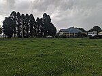
Shoalhaven River
City of ShoalhavenRivers of New South WalesShoalhaven RiverSouth Coast (New South Wales)Southern Tablelands ... and 1 more
Use Australian English from May 2013

The Shoalhaven River is a perennial river that rises from the Southern Tablelands and flows into an open mature wave dominated barrier estuary near Nowra on the South Coast of New South Wales, Australia.
Excerpt from the Wikipedia article Shoalhaven River (License: CC BY-SA 3.0, Authors, Images).Shoalhaven River
Plover Street, Shoalhaven City Council
Geographical coordinates (GPS) Address Nearby Places Show on map
Geographical coordinates (GPS)
| Latitude | Longitude |
|---|---|
| N -34.85 ° | E 150.73333333333 ° |
Address
Plover Street
Plover Street
2535 Shoalhaven City Council
New South Wales, Australia
Open on Google Maps


