place

Ysbyty Ifan

Listed buildings in Conwy County BoroughRegistered historic parks and gardens in Conwy County BoroughYsbyty Ifan
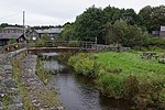
Ysbyty Ifan, parish church of St. John

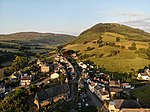
Ysbyty Ifan (often formerly anglicised as Yspytty Ifan) is a small, historic village and community in the Conwy County Borough of Wales. The population in 2011 was 196 in 76 households (29 household spaces had no usual residents), over 79% of the population were able to speak Welsh. It has one of the smallest populations of any Welsh community, the smallest being Ganllwyd. It is in the electoral ward of Uwch Conwy.

Excerpt from the Wikipedia article Ysbyty Ifan (License: CC BY-SA 3.0, Authors, Images).

Ysbyty Ifan
High Street,

Geographical coordinates (GPS) Address Nearby Places
placeShow on map

Wikipedia: Ysbyty IfanContinue reading on Wikipedia

Geographical coordinates (GPS)

Latitude Longitude
N 53.024 ° E -3.728 °
placeShow on map

Address

High Street 1
LL24 0NH , Ysbyty Ifan
Wales, United Kingdom
mapOpen on Google Maps

Ysbyty Ifan, parish church of St. John
Share experience

Nearby Places

Pentrefoelas
Pentrefoelas

Pentrefoelas is a village and community in Conwy County Borough, Wales. The village lies on the A5 road between Betws-y-Coed to the west and Cerrigydrudion to the east. The Afon Merddwr river, a tributary of the River Conwy, flows through it. The community had a population of 356 at the time of the 2011 census, 70% were able to speak Welsh. It has an area of 53.86 km2 and covers a large region around the village including part of Mynydd Hiraethog, Llyn Alwen and part of Alwen Reservoir. It is in the electoral ward of Llangernyw. The community includes the small settlement of Rhydlydan. The name of the village comes from pentre (Welsh for "village") and a nearby hill, Foel Las ("green bare-topped hill"). The hill is the site of a motte built around 1164 in the time of Owain Gwynedd. Old Voelas House (or Plas Foel Las), mansion of the Wynne family, was built at the foot of the hill in 1545. It was demolished in 1819 and a new site was established two kilometres to the west. The current Voelas Hall was built in 1961 and was designed by the architect Clough Williams-Ellis.Other buildings around the village include: Plas Iolyn, home to Rhys Fawr ap Maredudd, his son Robert ap Rhys (the chaplain to Cardinal Wolsey), his grandson the 16th-century MP Elis Prys (known as Dr Coch and notorious for his oppression of the district) and his great-grandson, the poet Tomos Prys. It is now a farmhouse. Gilar, built in the 16th century for the poet Rhys Wyn ap Cadwaladr (fl. c. 1600), perhaps by his father Cadwaladr ap Maurice after receiving a substantial grant of land from Henry VIII in 1545–1546, which included the land later occupied by Plas Iolyn and Old Voelas House. The village had a chapelry of Ysbyty Ifan built in 1766 and known as Voelas Chapel. The Parish Church was built on the same site in 1857–1859. The Pentrefoelas watermill (Melin Voelas) for grinding flour dates from 1815 and was restored by Clwyd County Council as part of a heritage scheme. The ironwork for the external overshot waterwheel was originally cast by the Llanrwst Foundry probably sometime in the 19th century

Bro Garmon
Bro Garmon

Bro Garmon is a sparsely populated community in Conwy County Borough, in Wales. It is located on the eastern side of the Conwy Valley, stretching from north east of Llanrwst to just west of Pentrefoelas, and includes the villages of Capel Garmon, Glan Conwy, Melin-y-Coed, Nebo, Oaklands, Rhydlanfair and Pentre-tafarn-y-fedw. Moel Seisiog, on the eastern boundary, rises to a height of 1,535 feet (468 m). The main settlement, Capel Garmon, lies 2.4 miles (3.9 km) east of Betws-y-Coed, 5.2 miles (8.4 km) north west of Pentrefoelas, 4.4 miles (7.1 km) south of Llanrwst and 15.7 miles (25.3 km) south of Conwy. At the 2001 census the community had a population of 648, increasing slightly at the 2011 census to 652.Saint Garmon's church, in Capel Garmon, was consecrated in 1862, but is no longer in use. An Iron Age firedog, discovered buried in a nearby field in 1852, and now held at the National Museum of Wales, is considered to have been produced by a master craftsman. It depicts two mythical creatures, part horse and part bull, and is rated as one of the most important examples of decorative ironwork found in the United Kingdom. To the south of the village, a Neolithic chamber tomb has been dated to 5,500 years ago. Nearby, Melin Plas-yn-Rhos is a water-powered corn mill thought to date from the 18th century.Waterloo Bridge, which carries the A5 across the River Conwy to Betws-y-Coed, was built by Thomas Telford in 1815, the year of the Battle of Waterloo, and is made wholly from cast iron. It is Grade I listed, and Cyffdy Hall, at Melin-y-coed, and Cilcennus at Oaklands are Grade II* listed. Hendre House is a Grade II listed building. Its gardens and grounds are listed, also at Grade II on the Cadw/ICOMOS Register of Parks and Gardens of Special Historic Interest in Wales. Numerous other houses, farm buildings and several bridges in the community are also Grade II listed. The community is part of the Uwch Conwy ward for elections to Conwy County Borough Council.

Bro Machno
Bro Machno

Bro Machno is a community in Conwy County Borough, in Wales, formed from the former civil parish of Penmachno. It covers the Penmachno Valley, through which runs the Afon Machno, and includes the villages of Penmachno and Cwm Penmachno. To the south west borders Gwynedd, and is located 4.8 miles (7.7 km) south of Betws-y-Coed, 21.8 miles (35.1 km) north west of Corwen, and 19.4 miles (31.2 km) south of Conwy. The whole of the community is within the Snowdonia national park, while much of it forms part of Gwydir Forest. According to the 2011 census, the population of the Bro Machno Parish was 617, of whom 342 (55%) were able to speak Welsh and 214 (34%) had no skills in Welsh. Tŷ Mawr, a 16th-century farmhouse now owned by the National Trust, was the birthplace of William Morgan, who in 1588 first translated the whole Bible into Welsh. The building is Grade II* listed. Also listed is Coed-y-Ffynnon Farmhouse, where the poet Huw Machno died in 1637, Benar Farmhouse, below Penmachno and dating from the 16th century, Fedw Deg, a 16th-century old house in the north of the community, and Pen-y-Bryn Farmhouse, a 17th-century building overlooking the village.The Penmachno Document was drawn up by Madog ap Llywelyn in 1294, at the height of his rebellion against Edward I of England. It is the only surviving document issued by one of the Welsh leaders during the revolt, and in it Madog styles himself Prince of Wales, Lord of Snowdonia.At the head of the valley stands the village of Cwm Penmachno, above which Penmachno and Rhiwbach slate quarries opened at the start of the 19th century. By the 1860s, underground quarrying was being developed, later covering eight levels. Horses carried the slate down the Penmachno and Conwy valleys to Trefriw, until the Rhiwbach Tramway opened in 1863, when all the slate from the Rhiwbach quarry was transported to Blaenau Ffestiniog, to be carried by the Ffestiniog Railway to the harbour at Porthmadog. The Penmachno quarry continued to ship its slate out by road until it closed in 1962. Because of the remoteness, and inaccessibility during bad weather, of Rhiwbach quarry, the workers lived on site, and a small village developed, including a shop and school, in addition to family accommodation and a barracks for single men. Extensive remains of the village can still be seen, along with the ruins of the engine house which provided the power to haul the slate up the incline to the tramway. At the opposite end of the valley stands the former Penmachno Woollen Mill, a 19th-century water-powered fulling mill.The community is part of the Uwch Conwy ward for elections to Conwy County Borough Council.