Province of Jülich-Cleves-Berg
1815 establishments in Prussia1822 disestablishments in PrussiaFormer states and territories of North Rhine-WestphaliaHistory of the RhinelandProvinces of Prussia ... and 2 more
States and territories disestablished in 1822States and territories established in 1815

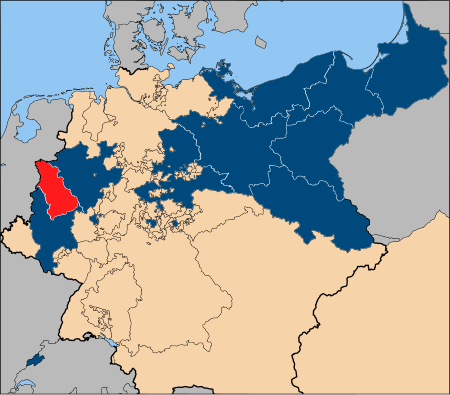
The Province of Jülich-Cleves-Berg (German: Provinz Jülich-Kleve-Berg) was a province of Prussia from 1815 to 1822. Jülich-Cleves-Berg was established in 1815 from land annexed by the Kingdom of Prussia from France and the Grand Duchy of Berg, and was dissolved in 1822 when it was merged with the Grand Duchy of the Lower Rhine to form Rhine Province. Cologne was the provincial capital.
Excerpt from the Wikipedia article Province of Jülich-Cleves-Berg (License: CC BY-SA 3.0, Authors, Images).Province of Jülich-Cleves-Berg
Konrad-Adenauer-Ufer, Cologne Neustadt/Nord (Innenstadt)
Geographical coordinates (GPS) Address Nearby Places Show on map
Geographical coordinates (GPS)
| Latitude | Longitude |
|---|---|
| N 50.95 ° | E 6.9666666666667 ° |
Address
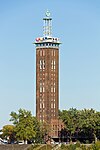
Bastei
Konrad-Adenauer-Ufer 80
50668 Cologne, Neustadt/Nord (Innenstadt)
North Rhine-Westphalia, Germany
Open on Google Maps


