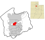
Salt Lake County, Utah

Salt Lake County is located in the U.S. state of Utah. As of the 2020 United States Census, the population was 1,185,238, making it the most populous county in Utah. Its county seat and largest city is Salt Lake City, the state capital. The county was created in 1850. Salt Lake County is the 37th most populated county in the United States and is one of four counties in the Rocky Mountains to make it into the top 100. (Others being Denver County and El Paso County, Colorado and Clark County, Nevada.) Salt Lake County is the only county of the first class in Utah - under the Utah Code (Title 17, Chapter 50, Part 5) is a county with a population of 700,000 or greater.Salt Lake County occupies the Salt Lake Valley, as well as parts of the surrounding mountains, the Oquirrh Mountains to the west and the Wasatch Range to the east (essentially the entire Jordan River watershed north of the Traverse Mountains). In addition, the northwestern section of the county includes part of the Great Salt Lake. The county is noted for its ski resorts; Salt Lake City hosted the 2002 Winter Olympics. Salt Lake County is the central county of the Salt Lake City metropolitan area. Sustained drought in Utah has more recently strained Salt Lake County's water security and has caused the Great Salt Lake level drop to record low levels.
Excerpt from the Wikipedia article Salt Lake County, Utah (License: CC BY-SA 3.0, Authors, Images).Salt Lake County, Utah
4630 South,
Geographical coordinates (GPS) Address Phone number Website Nearby Places Show on map
 Continue reading on Wikipedia
 Geographical coordinates (GPS)
| Latitude | Longitude |
|---|---|
| N 40.67 ° | E -111.93 ° |
Address
Fore Lakes Golf Course
4630 South
84123
Utah, United States
Open on Google Maps
Phone number
Website
forelakesgc.com