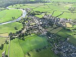
Stydd Brook
England river stubsLancashire geography stubsRivers of LancashireRivers of Ribble Valley

Stydd Brook is a watercourse in Lancashire, England. Rising on Gannow Fell, south west of the Forest of Bowland, the river flows southward, meeting the River Ribble at Ribchester. Stydd Brook flows by Black Plantation then between Moor Nook Farm and Davies Gate, before moving through Stydd Wood.
Excerpt from the Wikipedia article Stydd Brook (License: CC BY-SA 3.0, Authors, Images).Stydd Brook
Church Street, Preston
Geographical coordinates (GPS) Address Phone number Website Nearby Places Show on map
Geographical coordinates (GPS)
| Latitude | Longitude |
|---|---|
| N 53.8115 ° | E -2.5308 ° |
Address
Ribchester St Wilfrid's Church of England Voluntary Aided Primary School
Church Street
PR3 3XP Preston
England, United Kingdom
Open on Google Maps


