Aengwirden
Former municipalities of FrieslandFriesland geography stubs

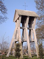
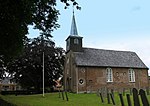
Aengwirden is a former municipality in the Dutch province of Friesland. It covered the area around the village of Tjalleberd. It existed until July 1, 1934. The area of the former municipality is now a part of the municipality of Heerenveen.
Excerpt from the Wikipedia article Aengwirden (License: CC BY-SA 3.0, Authors, Images).Aengwirden
Bornego, Heerenveen
Geographical coordinates (GPS) Address Nearby Places Show on map
Geographical coordinates (GPS)
| Latitude | Longitude |
|---|---|
| N 53 ° | E 5.9166666666667 ° |
Address
Bornego
Bornego
8449 EG Heerenveen
Frisia, Netherlands
Open on Google Maps


