place

Lytle Creek, California

1851 establishments in CaliforniaCensus-designated places in CaliforniaCensus-designated places in San Bernardino County, CaliforniaPopulated places established in 1851San Gabriel Mountains
Use mdy dates from July 2023
Pseudotsuga macrocarpa LytleCreek2

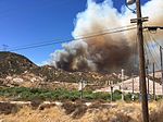
Lytle Creek is a census-designated place in the San Gabriel Mountains, within San Bernardino County. It is about 16 miles (26 km) northwest of downtown San Bernardino and 10 miles (16 km) from the cities of Fontana and Rialto. This small remote community is located in a large southeast-trending canyon on the eastern portion of the San Gabriel Mountains completely within the boundaries of the San Bernardino National Forest. The population was 701 at the 2010 census. The ZIP Code for Lytle Creek is 92358 and the community is inside area code 909.

Excerpt from the Wikipedia article Lytle Creek, California (License: CC BY-SA 3.0, Authors, Images).

Lytle Creek, California
Meadow Lane,

Geographical coordinates (GPS) Address Nearby Places
placeShow on map

Wikipedia: Lytle Creek, CaliforniaContinue reading on Wikipedia

Geographical coordinates (GPS)

Latitude Longitude
N 34.259166666667 ° E -117.49916666667 °
placeShow on map

Address

Meadow Lane 13934
92358
California, United States
mapOpen on Google Maps

Pseudotsuga macrocarpa LytleCreek2
Share experience

Nearby Places

Santa Fe And Salt Lake Trail Monument

The Santa Fe And Salt Lake Trail Monument was designated a California Historic Landmark (No.576) on May 17, 1957. Santa Fe And Salt Lake Trail Monument marks the place two Historic trail merged in Cajon Pass in San Bernardino County, California. The Old Spanish Trail (trade route) and the Mohave Trail-Mojave Road merged in Cajon Pass. The large white marker is just off the Interstate 15 in Cajon Pass, was U.S. Route 66 in the past. It was built by the Pioneer Society of San Bernardino to remember and honor the pioneers that came west. The marker is 12 feet tall and 7 feet square at the base. Cajon Pass was home to the Serrano Indian, Native Californians that lived in the nearby Atongaibit village, in what is now Hesperia. In Summit Valley was the village of Guapiabit, and in Cajon Canyon the village of Amuscopiabit. The pass was used by native in prehistory. The San Andreas Fault runs through and made the 3,777 ft (1,151 m) mountain pass between the San Bernardino Mountains and the San Gabriel Mountains in Southern California. One side in the Mojave Desert and the other the Los Angeles Basin. The Monument is specially dedicated to those that cross the pass on June 20, 1851, as part of the '49s. Sheldon Stoddard and Sydney P. Waite are two of the pioneers that crossed the pass in 1851. They were part of what is now called the Death Valley '49ers that crossed the pass after surviving a wrong detour though Death Valley in 1949. In addition to building the monument, the Pioneer Society of San Bernardino built a log cabin, picnic tables and benches in the mountains and San Bernardino for the public to use.