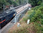
Ryhill

Ryhill is a small village and civil parish situated on the B6428 road in West Yorkshire, England approximately 7 miles (11 km) south-east of the city of Wakefield. It has a population of 2,628, increasing to 2,894 at the 2011 census.Like many of the surrounding villages, it is still recovering from the effects of pit closures which has seen the demise of the many collieries which once surrounded the village. The local economy is currently enjoying a return to prosperity as new housing developments have made the village popular with commuters to nearby towns. The first mention of Ryhill in recorded history is an entry in the 1086 Domesday Book which describes 'Rihella' as having 4 ploughlands and an area of pasturable woodland. The name "Ryhill" itself is almost self-explanatory: it simply means "hill where rye is grown". Originating in Old English, the name is formed of the elements ryge and hyll.An alternative interpretation is for 'Ra', which refers to Roe Deer. Both of the interpretations seem feasible; the village itself has a long-standing history in farming, but the naming of surrounding connected areas poses an interesting possibility for Roe Deer, Wintersett immediately below Ryhill being a place to take livestock during the winter months, Nostell being a Roman stable, Newstead being grazing land, Cold Hiendley and South Hiendley also suggestive of clearings for livestock, possibly with connections to the larger Saxon settlement at Ringstone Hill, Brierley.
Excerpt from the Wikipedia article Ryhill (License: CC BY-SA 3.0, Authors, Images).Ryhill
Tun Lane, Wakefield
Geographical coordinates (GPS) Address Nearby Places Show on map
Geographical coordinates (GPS)
| Latitude | Longitude |
|---|---|
| N 53.616764 ° | E -1.402057 ° |
Address
Tun Lane
Tun Lane
S72 9DE Wakefield
England, United Kingdom
Open on Google Maps


