Finglen Burn
Rivers of East DunbartonshireScotland river stubs
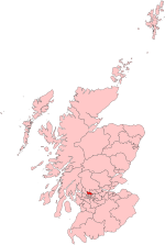
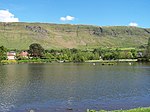
The Finglen Burn is a burn in Scotland that runs from north east of the Earl's Seat (the highest point on the Campsie Fells) to just north of Campsie Village where it merges with the Kirk Burn to form the Glazert Water. Named tributaries of the burn from the earliest to the latest are as follows: Cooper's Gote, Flaughter Burn, Earl's Burn, Altmarrage Burn, Almarnock Burn, Horse Burn, Almeel Burn and finally the Pow Burn.In the History of Stirlingshire by William Nimmo, the burn is said to be named "to the alleged ancient resort of Giants".
Excerpt from the Wikipedia article Finglen Burn (License: CC BY-SA 3.0, Authors).Finglen Burn
Down The Steps MTB Trail,
Geographical coordinates (GPS) Address Nearby Places Show on map
Geographical coordinates (GPS)
| Latitude | Longitude |
|---|---|
| N 55.979765 ° | E -4.228416 ° |
Address
Down The Steps MTB Trail
Down The Steps MTB Trail
G66 7LP
Scotland, United Kingdom
Open on Google Maps


