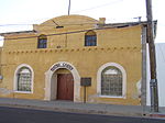
place

Tucson Origins Heritage Park

Arizona building and structure stubsHistoric sites in ArizonaTucson, Arizona

Tucson Origins Heritage Park is an under construction historic park located in Tucson, Arizona, United States. The park is located between Sentinel Peak and the Santa Cruz River. The park is directly accessible from the Cushing & Convento Sun Link station.

Excerpt from the Wikipedia article Tucson Origins Heritage Park (License: CC BY-SA 3.0, Authors).

Tucson Origins Heritage Park
West Mission Lane, Tucson

Geographical coordinates (GPS) Address Nearby Places
placeShow on map

Wikipedia: Tucson Origins Heritage ParkContinue reading on Wikipedia

Geographical coordinates (GPS)

Latitude Longitude
N 32.215 ° E -110.9847 °
placeShow on map

Address

West Mission Lane 416
85745 Tucson
Arizona, United States
mapOpen on Google Maps

Share experience

Nearby Places

Mission Garden
Mission Garden

Mission Garden is a living agricultural museum near Sentinel Peak in Tucson, Arizona. Its adobe walls enclose four acres of heritage crops and heirloom trees. These plants represent cultures that have lived in the Sonoran Desert over the past 4,000 years. People who have lived here include Hohokam, Tohono O’odham, Spanish colonials and other Europeans, Mexicans, Chinese, and people of African descent. As a result, Mission Garden grows crops that originated in many areas of the world. Some of these crops are listed in the Ark of Taste's catalog of heritage foods. White Sonora wheat and O'odham pink bean exemplify local foods in this catalog. Staff and volunteers tend constantly changing garden plots that show cultivars and farming methods that have succeeded in the Sonoran Desert. Mission Garden also hosts regular and special events about these foods. The gardens and events combine traditional and modern knowledge related to agriculture in this hot and arid region. This focus is relevant in the context of food insecurity and climate change. Collaborations with other organizations enhance Mission Garden's mission (quoted below). Mission Garden inspires people to connect to this land by reclaiming agricultural traditions for our community in a changing world.This historical and cultural resource figured in Tucson’s successful application to UNESCO’s Creative Cities Network. And in 2015, Tucson became the first City of Gastronomy in the United States. It is noted especially for its culture and development of Sonoran Mexican cuisine. People who visit Tucson because of its City of Gastronomy designation often include Mission Garden among their food-related destinations. Related media attention has included pieces in Bon Appétit, the Boston Globe, the Denver Post, Forbes, and the New York Times.

El Tiradito
El Tiradito

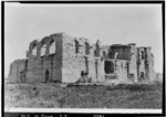
El Tiradito is a shrine and popular local spot located at 420 South Main Avenue in the Old Barrio area of Downtown Tucson, Arizona. The shrine consists of the crumbling remains of a brick building, with a large metal rack for candles and desert plants now occupying the interior. Large, glass-encased candles, frequently depicting saints of the Roman Catholic Church are lit and left burning at the shrine, both on the stand and along the ledges of the building. Small slips of paper containing prayers or messages of thanks are also often pressed into cracks in the walls or left elsewhere at the shrine, as are other memorial objects. In addition to the faithful who leave these religious objects, El Tiradito is frequented and favored by many Tucsonans, including writers, poets, and other members of the town's artistic community. According to the Phoenix New Times publication, El Tiradito is the only Catholic shrine in the United States dedicated to a sinner buried in unconsecrated ground. It is said that the man buried there died fighting for the love of a woman. Visitors to this area light candles for the man, hoping his soul will be freed from purgatory. Some of the nooks and crannies of El Tiradito even house the notes and letters of the heartbroken, prayers asking for healing of the heart. El Tiradito was listed on the U.S. National Register of Historic Places in 1971. It was documented in the Historic American Landscapes Survey in 2012.It was described in 2021 as "a three-sided shrine of crumbling adobe walls, small and nondescript, mere streets away from the bustle and noise of downtown Tucson."
Barrio Libre
Barrio Libre

Barrio Libre is a neighborhood in Tucson, Arizona notable for its existence as a relatively unchanged 19th-century Hispanic neighborhood of close-packed row houses. Houses in the barrio are typically adobe with very plain detailing, reflecting the area's history as a district of townhouses for Mexican ranching families. The location of the district shifted through history. In 1881, Barrio Libre was directly south of Tucson's business district. It was known as being where "the lower class of Mexicans and the Papago [Tohono O'odham] and Yaqui Indians held high or low carnival without being interrupted by officers of the law." By 1940, Barrio Libre had shifted south, and the former area was known as La Calle Convento or La Calle Meyer. In 1960, James Officer moved the neighborhood's boundary north to Broadway. Thomas Sheridan's 1986 map of local barrios put Barrio Libre further south, on the other side of 22nd street, though Sheridan noted the vague determinations of Barrio Libre's location. The district, as delineated by the National Park Service, includes more than 200 contributing structures, with relatively few non-conforming buildings. The district is bounded by 14th and 18th streets to the north and south, and by Stone and Osborne to the east and west. Meyer Avenue runs through the center of the barrio. It is also known as Barrio Viejo or the Barrio Histórico. In the late 1960, the Tucson Convention Center was built, obliterating much of the neighborhood. Barrio Libre has a dense population of murals. The district was listed on the National Register of Historic Places on October 18, 1978.