Doux (river)
Ardèche geography stubsFrance river stubsHaute-Loire geography stubsMassif CentralPages including recorded pronunciations ... and 6 more
Pages with French IPARivers of ArdècheRivers of Auvergne-Rhône-AlpesRivers of FranceRivers of Haute-LoireTributaries of the Rhône

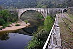
The Doux (French pronunciation: [du] ) is a tributary of the Rhône in the Haute-Loire and Ardèche departments, France. It is 70 km (43 mi) long. It begins in the Massif Central and joins the Rhône in Tournon-sur-Rhône. It passes through the town Lamastre. The Chemin de fer du Vivarais heritage railway from Tournon-sur-Rhône to Lamastre runs through the Doux valley.
Excerpt from the Wikipedia article Doux (river) (License: CC BY-SA 3.0, Authors, Images).Doux (river)
Promenade Roche Defrance, Tournon-sur-Rhône
Geographical coordinates (GPS) Address Phone number Website Nearby Places Show on map
Geographical coordinates (GPS)
| Latitude | Longitude |
|---|---|
| N 45.0729 ° | E 4.8292 ° |
Address
Camping Le Rhône
Promenade Roche Defrance 1
07300 Tournon-sur-Rhône
Auvergne-Rhône-Alpes, France
Open on Google Maps


