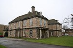
Don Gorge
Use British English from June 2022Valleys of Yorkshire

The Don Gorge is the valley of the River Don to the west of Doncaster, south of the village of Sprotbrough. The gorge is known as a 'green corridor'. A weir is on the river at Sprotbrough, and this is bypassed by a canal with a lock. The abandoned hamlet of Levitt Hagg sits in woodland to the south of the river. The Sprotbrough Flash nature reserve lies adjacent to the river on its north bank. Boat Lane provides vehicular access into the village; additionally there is a public footpath. Mill Lane connects the Don Gorge with Warmsworth to the south.
Excerpt from the Wikipedia article Don Gorge (License: CC BY-SA 3.0, Authors, Images).Don Gorge
Mill Lane, Doncaster Warmsworth
Geographical coordinates (GPS) Address Nearby Places Show on map
Geographical coordinates (GPS)
| Latitude | Longitude |
|---|---|
| N 53.502 ° | E -1.192 ° |
Address
Mill Lane
DN5 7LY Doncaster, Warmsworth
England, United Kingdom
Open on Google Maps


