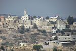
Ateret
1981 establishments in the Israeli Military GovernorateCommunity settlementsIsraeli settlements in the West BankMateh Binyamin Regional CouncilPopulated places established in 1981 ... and 1 more
Religious Israeli settlements
Ateret (Hebrew: עֲטֶרֶת, lit. Crown) is an Israeli settlement organized as a community settlement in the West Bank. Located in the municipal jurisdiction of the Mateh Binyamin Regional Council, it is located on a hilltop, at an elevation of 760 metres, occupying land confiscated by Israel from three nearby Palestinian villages: Ajjul, 'Atara, and Umm Safa. In 2021 it had a population of 954. The international community considers Israeli settlements in the West Bank illegal under international law, but the Israeli government disputes this.
Excerpt from the Wikipedia article Ateret (License: CC BY-SA 3.0, Authors).Ateret
Bnay Chashmonai,
Geographical coordinates (GPS) Address Nearby Places Show on map
Geographical coordinates (GPS)
| Latitude | Longitude |
|---|---|
| N 31.999722222222 ° | E 35.176944444444 ° |
Address
Bnay Chashmonai 45
Judea and Samaria, Palestinian Territories
Open on Google Maps


