place

Washington State Fair

Annual events in Washington (state)Annual fairsFairs in Washington (state)Festivals established in 1900History of Washington (state)
Puyallup, WashingtonState fairsTourist attractions in Pierce County, WashingtonUse mdy dates from November 2022
Puyallup Fair Logo
Puyallup Fair Logo

The Washington State Fair, formerly the Puyallup Fair, is the largest single attraction held annually in the U.S. state of Washington. It continually ranks in the top ten largest fairs in the United States and includes agricultural and pastoral displays and shows, amusement rides, and concert series. The Washington State Fair hosts two annual events: the 21-day Washington State Fair in September, and the four-day two weekend Washington State Spring Fair in April. Situated in the city of Puyallup, 35 miles (56 km) south of Seattle and 10 miles (16 km) east of Tacoma near Mount Rainier, the fairgrounds cover an area of 160 acres (0.65 km2) with buildings and land valued at more than $54 million. The facilities are available for rent throughout the year, making the grounds a valuable community resource. They also host various seasonal festivals such as the Victorian Country Christmas, as well as races, concerts, car shows, and sporting expositions, including the International Sportsman's Exposition. The site employs 55 year-round staff members. Over 7,500 employees are hired each September during the Fair.

Excerpt from the Wikipedia article Washington State Fair (License: CC BY-SA 3.0, Authors, Images).

Washington State Fair
9th Avenue Southwest,

Geographical coordinates (GPS) Address Website External links Nearby Places
placeShow on map

Wikipedia: Washington State FairContinue reading on Wikipedia

Geographical coordinates (GPS)

Latitude Longitude
N 47.182 ° E -122.297 °
placeShow on map

Address

Washington State Fair

9th Avenue Southwest 110
98371
Washington, United States
mapOpen on Google Maps

Website
thefair.com

linkVisit website

linkWikiData (Q7262636)
linkOpenStreetMap (52595837)

Puyallup Fair Logo
Puyallup Fair Logo
Share experience

Nearby Places

Camp Harmony
Camp Harmony

Camp Harmony is the unofficial euphemistic name of the Puyallup Assembly Center, a temporary facility within the system of internment camps set up for Japanese Americans during World War II. Approximately 7,390 Americans of Japanese descent from Western Washington and Alaska were sent to the camp (nearly doubling the town of Puyallup's then-population of 7,500) before being transferred to the War Relocation Authority camps at Minidoka, Idaho, Tule Lake, California and Heart Mountain, Wyoming. Camp Harmony was established in May 1942, shortly after the attack on Pearl Harbor and President Roosevelt's subsequent Executive Order 9066, which authorized the eviction of Japanese Americans from the West Coast. The location for the assembly center was on and around the Western Washington Fairgrounds in Puyallup, Washington. It consisted of four distinct areas: A, with a population of about 2000, located northeast of the fairgrounds. B, with a population of about 1200, just east of the fairgrounds in the vicinity of the current Blue parking lot. C, with a population of about 800, located northwest of the fairgrounds. D, with a population of about 3000, located on the fairgrounds proper in the area including the racetrack and grandstand, east of the roller coaster.The barracks "apartments" were designed to allow 50 square feet of space per individual, with one small window, a single electrical socket and a wood stove. Each area contained several mess halls, laundry facilities and latrines. A 100-bed hospital was built in Area D, and existing facilities were used as administration offices and community centers.In May and June 1942, just under 100 Japanese Americans left Camp Harmony to find work or attend school outside the exclusion zone, or to repatriate to Japan. On May 26, 196 men volunteered for an early transfer to Tule Lake to help finish construction on the camp there. The majority of the internees made the 30-hour train trip to Minidoka in 16 groups of approximately 500, beginning on August 12. The last train left the Puyallup station on September 12, and on September 30, 1942, the site was handed over to the Fort Lewis Ninth Service Command. The Puyallup Fairgrounds were then occupied by the U.S. Army 943rd Signal Service Battalion until they were transferred to Fort Lewis, Washington in December. The Puyallup Fairgrounds remained closed to the public until the end of the war, operating as an army training facility.After the Assembly Center closed the U.S. Army 943rd Signal Service Battalion were station at the camp for training before departing. The first postwar fair took place in September 1946. On November 25, 1978, the first Day of Remembrance was held at the Western Washington Fairgrounds, and over 2,000 attended. Five years later, on August 21, 1983, Governor John Spellman and Washington state representatives dedicated a sculpture by George Tsutakawa as a memorial to those confined at the wartime detention site.

Ezra Meeker Mansion
Ezra Meeker Mansion

The Meeker Mansion Museum is a historic house in Puyallup, Washington, United States. It is the second of two homes in the city which were resided in by Oregon Trail pioneer Ezra Meeker, the first one being a cabin on the homestead claim which Meeker purchased from Jerry Stilly in 1862. This was a one-room, 8 by 16 feet (2.4 by 4.9 m) square cabin to which Meeker added a second room, doubling its size. After the move to the mansion, Meeker donated the cabin site to the city, which they turned into Pioneer Park. The wooden cabin disappeared over time. Several steel and concrete pillars outline the dimensions of the original cabin. The Baltic ivy vine, originally planted by Eliza Jane Meeker and her daughter Ella meeker (Templeton), now covers the pillars where the original cabin once stood. A statue of Ezra Meeker was placed in the park and dedicated on September 14, 1926.The Meekers began construction on the house in 1886, contracting with Tacoma architects Farrell and Darmer. Construction of the Mansion was finished in December 1890 and Ezra and Eliza Jane Meeker officially cooked their first meal in the house on December 10, 1890 (as reported in the Tacoma Daily Ledger). Before the house was complete the Meekers held their youngest daughter Olive Grace Meeker's wedding on the front porch in October 1890. Meeker become wealthy through the production of hops, and was known as the "Hop King of the World". During the years in which Meeker lived at the mansion, he worked to trace and mark the Oregon Trail, also spending many hours writing on the subject as well as the history of Puget Sound (he would produce twelve books on these topics). The mansion was the social and political center of the valley during Meeker's lifetime. Its grounds feature holly trees which he brought over from England, and a ginkgo tree, an oak, sequoia, and California Redwoods. It is today home to the Puyallup Historical Society, who own and operate the Meeker Mansion Museum.

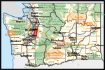
Washington's 9th congressional district

Washington's 9th congressional district encompasses a long, somewhat narrow area in Western Washington, through the densely populated central Puget Sound region, from Auburn and Federal Way in the south to parts of Seattle and Bellevue in the north. Since 1997, the 9th district has been represented in the U.S. House of Representatives by Adam Smith, a Democrat from Bellevue. Established after the 1990 U.S. census, the 9th district was originally drawn as a "fair fight" district. The first representative from the 9th district, Mike Kreidler (D), was defeated after one term by Republican Randy Tate; Tate, in turn, was defeated after one term by Smith. Since being first elected in 1996, Smith's moderate voting record and a strong Democratic trend in the Puget Sound region turned the formerly contentious district into a fairly safe Democratic seat. Al Gore and John Kerry each carried the 9th district, with 53% in 2000 and 2004, respectively. Barack Obama won the district in 2008, with 59% of the vote. In 2011, the state began the process of redistricting in response to population changes determined by the 2010 census. In the final report by the bipartisan redistricting commission issued in January 2012, the 9th district shifted to the north. The new district covered Bellevue, Southeast Seattle, and Mercer Island, but only went as far south as the southern tip of Commencement Bay in Tacoma. As of the 2022 redistricting, it is a majority-minority district and the second-most Democratic district in the state; only the neighboring 7th district, covering the rest of Seattle, is more Democratic.