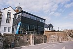
River Lym

The River Lym or River Lim is a short river, some 5 km (3.1 mi) in length, that flows through the Devon-Dorset border. It rises from multiple springs at Raymond's Hill, near the village of Uplyme in East Devon, and flows southeasterly through Dorset, into the English Channel via Lyme Bay in the town of Lyme Regis, Dorset. The river falls over 200 metres from its source.Some of the northern parts of the river are partly underground, and some points at Lyme Regis are culverted. Lyme Regis has grown around the southern course of the river, with residential houses, holiday cottages and bridges connected to it. In Saxon times, the abbots of Sherborne Abbey had salt-boiling rights on land adjacent to the River Lym, and in the 12th century the river powered three watermills, however today Town Mill, dating back to at least 1340, is the only watermill still in use.
Excerpt from the Wikipedia article River Lym (License: CC BY-SA 3.0, Authors, Images).River Lym
Broad Street,
Geographical coordinates (GPS) Address Nearby Places Show on map
Geographical coordinates (GPS)
| Latitude | Longitude |
|---|---|
| N 50.7244 ° | E -2.9326 ° |
Address
Rock Point Inn
Broad Street
DT7 3QD
England, United Kingdom
Open on Google Maps


