East Kapolei, Hawaii
Census-designated places in HawaiiCensus-designated places in Honolulu County, HawaiiHawaii geography stubsUse mdy dates from July 2023
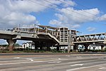
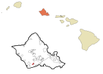
East Kapolei is a census-designated place (CDP) in Honolulu County, Hawaii, United States. It is on the south side of the island of Oahu and is bordered to the west by Kapolei, to the south by Ewa Villages, to the east by West Loch Estate, and to the north by Interstate H-1. By road it is 17 miles (27 km) northwest of downtown Honolulu. East Kapolei was first listed as a CDP prior to the 2020 census.
Excerpt from the Wikipedia article East Kapolei, Hawaii (License: CC BY-SA 3.0, Authors).East Kapolei, Hawaii
Iwikuamo'o Street, Kapolei Ho‘opili
Geographical coordinates (GPS) Address Nearby Places Show on map
Geographical coordinates (GPS)
| Latitude | Longitude |
|---|---|
| N 21.361944444444 ° | E -158.04527777778 ° |
Address
Iwikuamo'o Street
Iwikuamo'o Street
96706 Kapolei, Ho‘opili
Hawaii, United States
Open on Google Maps


