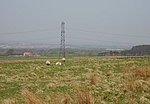
West Cairn Hill

West Cairn Hill is a hill in the Pentland Hills range of Scotland. With a height of 562 m (1,844 ft), it is the fifth highest elevation and lies on the western flank of the approximately 20 mi (32 km) long chain of hills.The border between the council areas of the Scottish Borders and West Lothian runs over the knoll. The closest settlement is the hamlet of Carlops around six kilometers to the southeast. West Calder is nine kilometers to the northwest and Penicuik is eleven kilometers to the east. The Cauldstane Slap pass runs at the saddle point between West and East Cairn Hill. The surrounding hills include Colzium Hill and Torweaving Hill in the southwest, East Cairn Hill in the northeast, and Wether Law in the east.
Excerpt from the Wikipedia article West Cairn Hill (License: CC BY-SA 3.0, Authors, Images).West Cairn Hill
Geographical coordinates (GPS) Address Nearby Places Show on map
Geographical coordinates (GPS)
| Latitude | Longitude |
|---|---|
| N 55.810555555556 ° | E -3.4258333333333 ° |
Address
Scottish Borders
Scotland, United Kingdom
Open on Google Maps


