place

Hackney Marshes

Areas of LondonCommon land in LondonHackney, LondonHomertonLee Valley Park
Marshland in LondonParks and open spaces in the London Borough of HackneyQueen Elizabeth Olympic ParkUse British English from June 2015
Hackney Marshes
Hackney Marshes

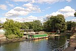
Hackney Marshes is an area of open space in London's Lower Lea Valley, lying on the western bank of the River Lea. It takes its name from its position on the eastern boundary of Hackney, the principal part of the London Borough of Hackney, and from its origin as an area of true marsh. The marshes were extensively drained from Medieval times onwards, and rubble was dumped here from buildings damaged by air raids during World War II, raising the level of the ground. The principal area of the marsh lies below Lea Bridge Road between the Old River Lea, and the Hackney Cut – an artificial channel of the Lee Navigation, dug about 1770, to avoid a loop in the natural watercourse. The southern extent is marked by the A12; although the industrial land around Hackney Wick Stadium was originally an extension of the marsh, it now forms a part of the Olympic Park for the 2012 Summer Olympics. Hackney Marsh is one of the largest areas of common land in Greater London, with 136.01 hectares (336.1 acres) of protected commons.

Excerpt from the Wikipedia article Hackney Marshes (License: CC BY-SA 3.0, Authors, Images).

Hackney Marshes
Lee Canal Towpath, London Homerton (London Borough of Hackney)

Geographical coordinates (GPS) Address Nearby Places
placeShow on map

Wikipedia: Hackney MarshesContinue reading on Wikipedia

Geographical coordinates (GPS)

Latitude Longitude
N 51.557 ° E -0.03 °
placeShow on map

Address

Lee Canal Towpath
E9 5PY London, Homerton (London Borough of Hackney)
England, United Kingdom
mapOpen on Google Maps

Hackney Marshes
Hackney Marshes
Share experience

Nearby Places

Mabley Green
Mabley Green

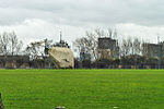
Mabley Green is a sizeable piece of common land adjacent to Homerton, Clapton Park and Hackney Wick in the east of the London Borough of Hackney measuring 35.5 acres (144,000 m2). Originally it was part of a continuous land mass on both sides of the Lee Navigation that formed the Hackney Marshes. in 1915 a piece of the Marshes was taken to create the National Projectile Factory and after World War I, in 1922, this site was used to create the Mabley Green recreation ground. Located next to the A12 road, it is linked to Hackney Wick and St Mary of Eton via the Red Path walkway and cycle path. It has an all-weather football pitch, an outdoor gym and basketball hoops. The park holds a Green Flag Award accreditation.The large and distinctive rock in the centre of the park was placed there in 2008 as part of an art project. It is designed as a rock climbing or bouldering challenge, having several routes of varying difficulty. It can also be viewed as a piece of sculpture. The stone weighs around 60 tonnes and was quarried in Cornwall. A book of photojournalism documenting the community using the wall during the Covid-19 pandemic, Mabley Green Class of '21 was published in 2022.To ensure adequate provision of football pitches while the East Marsh was being used for Olympic coach parking, the majority of Mabley Green was taken up with football pitches. Most of these are due to be removed from Mabley Green once the East Marsh pitches are restored during 2014. In 2021 a film, Mabley Green, by artist Alice May Williams commemorated the centenary of the Football Association's ban on women's football, celebrating the creation of a 'Munitionettes' women's football team at the location by workers at the National Projectile Factory.The User Group constitution expresses the ambition to be the UK's first edible park with fruit and nut trees and bushes available for all to enjoy. As part of a consultation process with the council, these plans are currently being considered along with plans to add another all-weather pitch.

London Borough of Waltham Forest

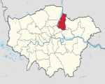
The London Borough of Waltham Forest () is a London borough in north-east London, England. Its population is estimated to be 276,983 in 2019. It borders five other London boroughs: Enfield to the north-west, Haringey to the west, Hackney to the south-west, Newham to the south-east and Redbridge to the east, as well as the non-metropolitan county of Essex to the north. The borough was formed in 1965 from the merger of the municipal boroughs of Leyton, Walthamstow and Chingford; it took its name from Waltham Forest – an institution which managed deer in south-west Essex. Epping Forest is a remainder of the former Waltham Forest and forms the eastern and northern fringe of the borough. The River Lea lies to the west where its associated marshes and parkland form a green corridor which, along the reservoir-lined reaches, separates north and east London, and is the historic border between Middlesex, and Essex The north and south of the borough, split by the North Circular Road, contrast markedly in terms of demographic and socio-economic indicators; with urban districts in the south having inner-city characteristics, and the more affluent suburban areas to the north having better access to open spaces, parks, and playing fields. Chingford in the north, Walthamstow in the middle, and both Leyton and Leytonstone in the south are the four urban centres of the borough. Waltham Forest was one of the host boroughs of the London Olympics in 2012, with the Lee Valley Hockey and Tennis Centre and part of the Queen Elizabeth Olympic Park providing an ongoing legacy in the UK and London.