Bowesfield
County Durham geography stubsStockton-on-TeesSuburbs in the United Kingdom
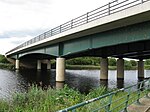
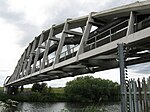
Bowesfield is an area of Stockton-on-Tees, County Durham, England. The area is located in the Ropner ward to the south of the town centre. The area is a mix of industrial, residential, and open space. The name Bowesfield, through Bowesfield Lane, can be found from Oxbridge Lane (just south of the town centre) through eastern Parkfield and down to Tees Jubilee Bridge. The former Bowesfield Farm originally overlooked old Thornaby on the opposite bank of the River Tees.Southern Bowesfield was once dominated by industrial areas such as the Bowesfield Works which has since been redeveloped into a housing estate.
Excerpt from the Wikipedia article Bowesfield (License: CC BY-SA 3.0, Authors).Bowesfield
Rigel Road,
Geographical coordinates (GPS) Address Nearby Places Show on map
Geographical coordinates (GPS)
| Latitude | Longitude |
|---|---|
| N 54.55 ° | E -1.3241666666667 ° |
Address
Rigel Road
Rigel Road
TS18 3XA , Hartwell
England, United Kingdom
Open on Google Maps


