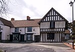
Kings Norton
All pages needing cleanupAreas of Birmingham, West MidlandsConservation areas in EnglandFormer wards of Birmingham, West MidlandsHarv and Sfn no-target errors ... and 2 more
Northfield ConstituencyWikipedia introduction cleanup from February 2022

Kings Norton, alternatively King's Norton, is an area of Birmingham, England. Historically in Worcestershire, it was also a Birmingham City Council ward within the Government of Birmingham, England. The district lies 6.5 miles south-southwest of Birmingham city centre and is within 1.5 miles of the north Worcestershire border. Kings Norton has been split into two wards, Kings Norton North and Kings Norton South.
Excerpt from the Wikipedia article Kings Norton (License: CC BY-SA 3.0, Authors, Images).Kings Norton
Masshouse Lane, Birmingham
Geographical coordinates (GPS) Address Nearby Places Show on map
Geographical coordinates (GPS)
| Latitude | Longitude |
|---|---|
| N 52.4072 ° | E -1.9272 ° |
Address
Masshouse Lane
Masshouse Lane
B38 9AS Birmingham
England, United Kingdom
Open on Google Maps


