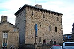
Rowley Burn (Northumberland)
England river stubsHistory of NorthumberlandNorthumberland geography stubsRivers of NorthumberlandTyne catchment

Rowley Burn (also known as Rowley Brook and Ham Burn, NY 9358) is a stream in Northumberland, running around three miles south of Hexham before joining the Devil's Water, which flows into the River Tyne.
Excerpt from the Wikipedia article Rowley Burn (Northumberland) (License: CC BY-SA 3.0, Authors, Images).Rowley Burn (Northumberland)
Geographical coordinates (GPS) Address Nearby Places Show on map
Geographical coordinates (GPS)
| Latitude | Longitude |
|---|---|
| N 54.92273 ° | E -2.08432 ° |
Address
NE46 1SP , Hexhamshire
England, United Kingdom
Open on Google Maps


