place

Clifton, Bristol

Areas of BristolClifton, BristolEngvarB from October 2013Former civil parishes in BristolSpa towns in England
Wards of Bristol
Bristol clifton
Bristol clifton

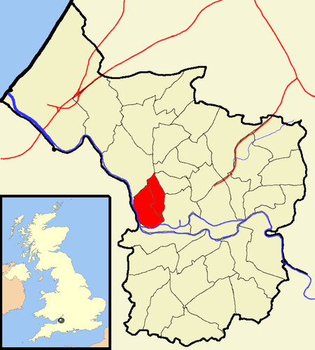
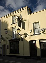
Clifton is both a suburb of Bristol, England, and the name of one of the city's thirty-five council wards. The Clifton ward also includes the areas of Cliftonwood and Hotwells. The eastern part of the suburb lies within the ward of Clifton Down. Notable places in Clifton include Clifton Suspension Bridge, Clifton Cathedral, Clifton College, The Clifton Club, Clifton High School, Bristol, Goldney Hall and Clifton Down.

Excerpt from the Wikipedia article Clifton, Bristol (License: CC BY-SA 3.0, Authors, Images).

Clifton, Bristol
Worcester Crescent, Bristol Clifton

Geographical coordinates (GPS) Address Nearby Places
placeShow on map

Wikipedia: Clifton, BristolContinue reading on Wikipedia

Geographical coordinates (GPS)

Latitude Longitude
N 51.46 ° E -2.62 °
placeShow on map

Address

Worcester Crescent

Worcester Crescent
BS8 3JA Bristol, Clifton
England, United Kingdom
mapOpen on Google Maps

Bristol clifton
Bristol clifton
Share experience

Nearby Places

Clifton College
Clifton College

Clifton College is a public school (English private boarding and day school for pupils aged 13–18) in the city of Bristol in South West England, founded in 1862. In its early years it was notable (compared with most public schools of the time) for emphasising science rather than classics in the curriculum, and for being less concerned with social elitism, e.g. by admitting day-boys on equal terms and providing a dedicated boarding house for Jewish boys, called Polack's House. Having linked its General Studies classes with Badminton School, it admitted girls to every year group (from pre-prep up to Upper 6th, excepting 5th form due to potential O-levels disruption) in 1987 and was the first of the traditional, boys, public schools to become fully coeducational. Polack's House closed in 2005 but a scholarship fund open to Jewish candidates still exists. Clifton College is one of the original 26 English public schools as defined by the Public Schools Yearbook of 1889. The school was also the headquarters of the US army in Britain during part of the Second World War. General Omar Bradley used the school's buildings as a staff office from October to November 1944.Clifton College is one of the few schools in the UK to have educated several Nobel laureates: Sir John Kendrew, who received the Nobel Prize in Chemistry in 1962; Sir John Hicks, winner of the 1972 Nobel Prize in Economics; and Sir Nevill Francis Mott, who received the Nobel Prize in Physics in 1977.

Whiteladies Road
Whiteladies Road

Whiteladies Road is a main road in Bristol, England. It runs north from the Victoria Rooms to Durdham Down, and separates Clifton on the west side from Redland and Cotham on the east. It forms part of the A4018. Significant buildings on Whiteladies Road include (from south to north): Broadcasting House, offices and studios of the British Broadcasting Corporation; the Whiteladies Picture House; Clifton Down railway station; Tyndale Baptist Church.Historically, the top half as far as Cotham Hill was the main easterly route into Bristol and the through route towards London and Bath from New Passage where there was a ferry from Wales. Later it was also the route into Bristol and onwards from the Port at Avonmouth. The road was extended in the early 1800s with the building of the second half of the street, and the route continued down Park Street. The main route from Avonmouth was superseded by the building of The Portway in the 1920s. Most of the traffic from Wales was removed after the building of the Severn Crossing and M4 in the 1960s, and traffic was further reduced later by the M32; however the modern A4018 still goes along much of the same route through Bristol, and now meets the M5 at Cribbs Causeway and is today still one of the important routes into west Bristol from the motorway. A shopping centre has been built around Clifton Down station, and to the north of the station Whiteladies Road has long been an important shopping area. The upper part of the road is commonly known as Blackboy Hill, named after the Black Boy Inn which stood on the hill until 1874. "Black Boy" was a common name for pubs after the Restoration. Charles II was commonly known as "the black boy" due to his black hair and the pub sign on Blackboy Hill had, until very recently, a portrait of Charles II on it. The origin of the name of Whiteladies Road appears to be a pub, known as the White Ladies Inn, shown on maps in 1746 and 1804. There is a popular belief in Bristol that the naming of both Whiteladies Road and Blackboy Hill had connections with the slave trade. However, both names appear to be derived from pubs. A map of 1826 shows a house called White Ladies, and the road at least as far as Whiteladies Gate (near the present site of Clifton Down station) had been given its name by that time. At that time the road north of Whiteladies Gate was a turnpike leading to New Passage.