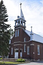
place

La Vallée-du-Richelieu Regional County Municipality

Census divisions of QuebecLa Vallée-du-Richelieu Regional County MunicipalityPages with non-numeric formatnum arguments
Quebec MRC La Vallée du Richelieu location map

La Vallée-du-Richelieu (The Valley of the Richelieu) is a regional county municipality in the Montérégie region in southwestern Quebec, Canada. Its seat is McMasterville. It surrounds the Richelieu River as the river flows north from Lake Champlain in the United States to the Saint Lawrence River northeast of Montreal at Sorel-Tracy, Quebec. Dramatically different from the mountainous terrain to the south, the river valley is a vast plain that has been developed with extensive farmlands. In the 21st century, the Richelieu River is very popular for both U.S. and Canadian recreational boaters, providing a connection that can bring boaters all the way from the outlet of the Saint Lawrence River to New York Harbor. A number of old fortifications exist dating back to the 17th century; they were built by the French in an effort to try to prevent the Iroquois from using the river as a way to attack the French settlers in the area. Fort Richelieu is at the mouth of the Richelieu River. Fort St. Louis (now Fort Chambly) at Chambly, Fort Sainte-Thérèse, and Fort Saint-Jean at Saint-Jean-sur-Richelieu, are on the way. Fort St. Anne Isle La Motte, Vermont in Lake Champlain is near the river's source. The region is informally known as la Vallée-des-Forts.

Excerpt from the Wikipedia article La Vallée-du-Richelieu Regional County Municipality (License: CC BY-SA 3.0, Authors, Images).

La Vallée-du-Richelieu Regional County Municipality
Rue Richelieu,

Geographical coordinates (GPS) Address Nearby Places
placeShow on map

Wikipedia: La Vallée-du-Richelieu Regional County MunicipalityContinue reading on Wikipedia

Geographical coordinates (GPS)

Latitude Longitude
N 45.566666666667 ° E -73.2 °
placeShow on map

Address

Rue Richelieu
J3G 4P8
Quebec, Canada
mapOpen on Google Maps

Quebec MRC La Vallée du Richelieu location map
Share experience

Nearby Places

Mont Saint-Hilaire
Mont Saint-Hilaire

Mont Saint-Hilaire (English: Mount Saint-Hilaire; Western Abnaki: Wigwômadenek, Wigwômadensizek;, Western Abnaki: Wigwômaden; see § Names of Mont Saint-Hilaire for other names) is a mountain, 414 m (1,358 ft) high, in the Montérégie region of southern Quebec. It is about thirty kilometres east of Montreal, and immediately east of the Richelieu River. It is one of the Monteregian Hills. Around the mountains are the towns of Mont-Saint-Hilaire and Saint-Jean-Baptiste. Other nearby towns include Otterburn Park, Beloeil and McMasterville. The area surrounding the mountain is a biosphere reserve, as one of the last remnants of the primeval forests of the Saint-Lawrence valley. Most of the mountain is currently the property of McGill University, as the Gault Nature Reserve, which is considered the third McGill campus. The University has opened the western half of the mountain to visitors (at a fee) for hiking and cross-country skiing, as the Milieu Naturel (natural area). The eastern half, or Milieu de Conservation (preservation area) is not accessible to the general public. Until the late nineteenth century, the lack of information on more remote summits of Quebec, as well as the relatively high prominence (about 400 m (1,312 ft)) of Mont Saint-Hilaire, led to it being mistaken as the highest summit in Québec. In actuality, Saint-Hilaire's 414 metres falls far short of making it the highest mountain in Quebec.Mont Saint-Hilaire is home to a wide variety of fauna and flora, as well as a number of rare minerals, including some which were discovered on the mountain and some which are unique to the region. These minerals are exploited by a quarry on the north-eastern side of the mountain. In addition, the soil is ideal for the growth of apple trees, and the mountain's apple orchards draws tens of thousands of visitors each year.