Aguada, Puerto Rico
1508 establishments in the Spanish EmpireAguada, Puerto RicoAguadilla–Isabela–San Sebastián metropolitan areaCaribbean cultureMunicipalities of Puerto Rico ... and 5 more
Pages with Spanish IPAPopulated coastal places in Puerto RicoPopulated places established in 1508Puerto Rican folkloreUse mdy dates from November 2022

Aguada (; Spanish: [aˈɣwaða], locally [aˈwaða]), originally San Francisco de Asís de la Aguada, is a town and municipality of Puerto Rico, located in the western coastal valley region bordering the Atlantic Ocean, east of Rincón, west of Aguadilla and Moca; and north of Añasco and Mayagüez. It is part of the Aguadilla-Isabela-San Sebastián Metropolitan Statistical Area. Aguada's population is spread over 17 barrios and Aguada Pueblo (the downtown area and the administrative center of the city).
Excerpt from the Wikipedia article Aguada, Puerto Rico (License: CC BY-SA 3.0, Authors, Images).Aguada, Puerto Rico
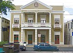
Calle La Paz,
Geographical coordinates (GPS) Address Nearby Places Show on map
 Continue reading on Wikipedia
 Geographical coordinates (GPS)
| Latitude | Longitude |
|---|---|
| N 18.379444444444 ° | E -67.188333333333 ° |
Address
Calle La Paz 229
00602 (Barrio Pueblo)
Puerto Rico, United States
Open on Google Maps