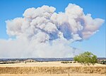
Bidwell Park

Bidwell Park is a municipal park located in Chico, California. The park was established July 10, 1905, through the donation by Annie Bidwell, widow of Chico's founder, John Bidwell, of approximately 2,500 acres (1,000 hectares) of land to the City of Chico. Since that time, the city has purchased additional land, such as Cedar Grove in 1922, and 1,200 acres (490 ha) of land south of Big Chico Creek in upper Bidwell Park in 1995. As of 2009, the total park size is 3,670 acres (1,490 ha), nearly 11 miles (18 km) in length, making it the third largest municipal park in California and is one of the largest city parks in the United States.Bidwell Park is divided by Manzanita Avenue. The area west of Manzanita Avenue is referred to as Lower Park and the area to the east is referred to as Middle and Upper Park. Middle Park extends from Manzanita to a point roughly equal to the upstream edge of the Chico Municipal Golf Course. The Upper/Middle and Lower Parks have differing terrain. Upper Park is located in the foothills of the southernmost Cascades. It has steep terrain and shallow soils, and contains many rock formations, including the unique Chico Formation sandstone, Lovejoy Basalt, and Tuscan Formation rocks. Lower Park is flat and level with a deep soil structure supporting a thick canopy of trees which provide ample shade for visitors. Special rules apply in the Upper Park and the road is unpaved for much of its length.
Excerpt from the Wikipedia article Bidwell Park (License: CC BY-SA 3.0, Authors, Images).Bidwell Park
Upper Park Road, Chico
Geographical coordinates (GPS) Address Nearby Places Show on map
Geographical coordinates (GPS)
| Latitude | Longitude |
|---|---|
| N 39.769888 ° | E -121.779156 ° |
Address
Upper Park Road
Chico
California, United States
Open on Google Maps


