Ribeirão Pires
Municipalities in São Paulo (state)São Paulo (state) geography stubs

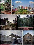
Ribeirão Pires (Pires Stream) is a city in the Metropolitan Region of the city of São Paulo, in the state of São Paulo, Brazil. It is part of the "ABC Region." The population is 124,159 (2020 est.) in an area of 99.1 km2. The elevation is 763 m. Its neighboring cities are Ferraz de Vasconcelos to the north, Suzano to the northeast and east, Rio Grande da Serra to the southeast and south, Santo André southwest, and Mauá northwest. The city is served by trains from Line 10 of CPTM. It became its own municipality in 1953, following its emancipation from Santo André.
Excerpt from the Wikipedia article Ribeirão Pires (License: CC BY-SA 3.0, Authors, Images).Ribeirão Pires
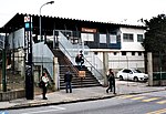
Rua Doutor Pirajá, Ribeirão Pires Núcleo Colonial (Ribeirão Pires)
Geographical coordinates (GPS) Address Nearby Places Show on map
Geographical coordinates (GPS)
| Latitude | Longitude |
|---|---|
| N -23.715277777778 ° | E -46.419444444444 ° |
Address
Rua Doutor Pirajá
Rua Doutor Pirajá
09424-100 Ribeirão Pires, Núcleo Colonial (Ribeirão Pires)
São Paulo, Brazil
Open on Google Maps


