place

Oświęcim County

Land counties of Lesser Poland VoivodeshipOświęcim County
Malopolskie oswiecim county

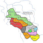
Oświęcim County (Polish: powiat oświęcimski) is a unit of territorial administration and local government (powiat) in Lesser Poland Voivodeship, southern Poland. It came into being on January 1, 1999, as a result of the Polish local government reforms passed in 1998. Its administrative seat and largest town is Oświęcim, which lies 51 kilometres (32 mi) west of the regional capital Kraków. The county contains four other towns: Kęty, 17 km (11 mi) south of Oświęcim, Brzeszcze, 9 km (6 mi) south-west of Oświęcim, Chełmek, 8 km (5 mi) north of Oświęcim, and Zator, 16 km (10 mi) east of Oświęcim. The county covers an area of 406.03 square kilometres (156.8 sq mi). As of 2006, its total population is 153,390, out of which the population of Oświęcim is 40,979, that of Kęty is 19,252, that of Brzeszcze is 11,730, that of Chełmek is 9,065, that of Zator is 3,726, and the rural population is 68,638. The county contains the sites of the Auschwitz concentration camp complex (Auschwitz being the German name for Oświęcim).

Excerpt from the Wikipedia article Oświęcim County (License: CC BY-SA 3.0, Authors, Images).

Oświęcim County
Spokojna, gmina Oświęcim

Geographical coordinates (GPS) Address Nearby Places
placeShow on map

Wikipedia: Oświęcim CountyContinue reading on Wikipedia

Geographical coordinates (GPS)

Latitude Longitude
N 50.05 ° E 19.233333333333 °
placeShow on map

Address

Spokojna 14
32-600 gmina Oświęcim
Lesser Poland Voivodeship, Poland
mapOpen on Google Maps

Malopolskie oswiecim county
Share experience

Nearby Places

Przemsza
Przemsza

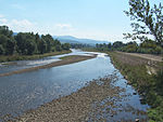
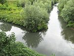
The Przemsza (German: Przemsa) is a river in the south of Poland, and a tributary of the Vistula. According to one view, it originates at the confluence of the Black (Polish: Czarna) Przemsza and White (Biała) Przemsza, between the towns of Mysłowice and Jaworzno. For about 24 km (15 mi) it flows southwards to its Vistula mouth at Czarnuchowice (a district of Bieruń). Another view places its beginning at the source of the Black Przemsza, giving it the length of 88 kilometers. The Przemsza is one of the most polluted rivers of Poland. It carries industrial waste from the Upper Silesia and Zagłębie Dąbrowskie Coal Basin, and its water is regarded as dead. Furthermore, due to high level of pollution, the Przemsza does not freeze over in winter. Among the towns located along the Przemsza are Dąbrowa Górnicza, Mysłowice, Jaworzno, Chełmek, and Jęzor, a district of Sosnowiec. The Przemsza has been used for water transport since the mid-18th century. By the mid-19th century, it emerged as one of the most important waterways of the region. Large flat-bottomed rowing boats, called pl:galars, were used to transport goods on the Przemsza to the Vistula. One galar took up to 70 tons of coal or stone from quarries at Jeleń or Dziećkowice. In June 1926, the Piast Mine from Lędziny began mass water transportation of its coal, using a specially constructed port, located at the village of Chełm Mały. Other mines followed Piast, opening their own loading facilities. By 1937, there were eight such facilities along the Przemsza. The government of the Second Polish Republic had far-reaching plans for the river. A river port at Niwka (a district of Sosnowiec) was to be built, a Mysłowice - Spytkowice - Kraków canal, and a waterway to the Baltic Sea. The outbreak of World War II terminated these plans. Since the 12th century, the river formed the eastern border of the Silesian Duchy of Racibórz, with Lesser Poland. From 1846 until 1918, the so-called Three Emperors' Corner at the confluence of Black and White Przemsza marked the tripoint of the Kingdom of Prussia, the Austrian Empire and the Russian Empire. Nowadays the lower Przemsza is the border between the Silesian Voivodeship in the west and the Lesser Poland Voivodeship in the east.