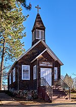
DeSabla, California
Butte County, California geography stubsUnincorporated communities in Butte County, CaliforniaUnincorporated communities in CaliforniaUse mdy dates from July 2023
DeSabla (also known as De Sabla, deSabla and de Sabla; formerly, Hupps Mill and Hupp) is an unincorporated community in Butte County, California. It lies at an elevation of 2762 feet (842 m). It was named after one of the Pacific Gas and Electric founders and is the site of Lake de Sabla reservoir and a powerhouse named for him. The community's ZIP code is 95954, and is shared with the community of Magalia. The area code is 530. NAD27 latitude and longitude for the community are 39°52′26″N 121°36′06″W and official elevation is 2,780 feet (850 m) above mean sea level.
Excerpt from the Wikipedia article DeSabla, California (License: CC BY-SA 3.0, Authors).DeSabla, California
Skyway Road,
Geographical coordinates (GPS) Address Nearby Places Show on map
Geographical coordinates (GPS)
| Latitude | Longitude |
|---|---|
| N 39.874444444444 ° | E -121.6125 ° |
Address
Skyway Road
Skyway Road
95978
California, United States
Open on Google Maps


