Ha Wo Hang
Hong Kong geography stubsSha Tau KokVillages in North District, Hong KongWalled villages of Hong Kong

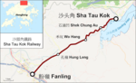
Ha Wo Hang (Chinese: 下禾坑; lit. 'lower Wo Hang', with Wo Hang meaning "valley of rice") is a village in Wo Hang, Sha Tau Kok, in the North District of Hong Kong. Part of the village is a walled village.
Excerpt from the Wikipedia article Ha Wo Hang (License: CC BY-SA 3.0, Authors, Images).Ha Wo Hang
Sha Tau Kok Road – Wo Hang, North District
Geographical coordinates (GPS) Address Nearby Places Show on map
 Continue reading on Wikipedia
 Geographical coordinates (GPS)
| Latitude | Longitude |
|---|---|
| N 22.527322 ° | E 114.198658 ° |
Address
祠堂 Tsz Tong
Sha Tau Kok Road – Wo Hang
518081 North District
Hong Kong, China
Open on Google Maps