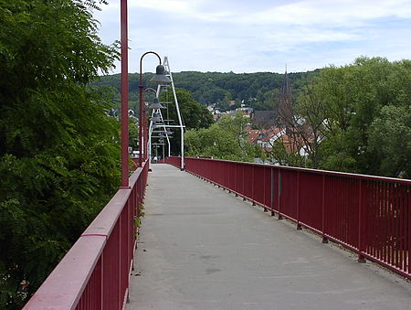
Friendship Bridge (Germany-France)

The Friendship Bridge (German: Freundschaftsbrücke, French: Pont de l'amitié) is a bridge which crosses the Saar river, south of Saarbrücken, and links the Saarland municipality of Kleinblittersdorf with the Lorraine commune of Grosbliederstroff. Although the idea of having a bridge between the two places, linked with each other for centuries, originated in the 1860s, the bridge was in fact first built in 1880. Having been destroyed at the beginning of the Second World War, it was newly built in 1964. The bridge's current form as a footbridge was constructed in 1993. While it impresses neither through architectural boldness nor through record breaking dimensions, the varied history of Franco-German relations, from "hereditary enmity" to a strong partnership within the European Union, can be interpreted through the bridge, especially since the 1963 Élysée Treaty came into force. While at times the bridge served as a border crossing between France and Germany, between these times it shifted between being seen as either an inner-German or an inner-French work of construction.
Excerpt from the Wikipedia article Friendship Bridge (Germany-France) (License: CC BY-SA 3.0, Authors, Images).Friendship Bridge (Germany-France)
Pont de l'Amitié / Freundschaftsbrücke, Sarreguemines
Geographical coordinates (GPS) Address External links Nearby Places Show on map
Geographical coordinates (GPS)
| Latitude | Longitude |
|---|---|
| N 49.1569 ° | E 7.0319 ° |
Address
Pont de l'Amitié / Freundschaftsbrücke
Pont de l'Amitié / Freundschaftsbrücke
57520 Sarreguemines
Grand Est, France
Open on Google Maps


