Erina Heights, New South Wales
Central Coast, New South Wales geography stubsSuburbs of the Central Coast (New South Wales)Use Australian English from August 2019
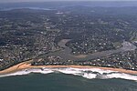
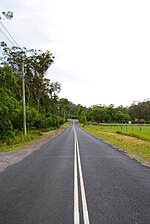
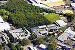
Erina Heights is a suburb of the Central Coast region of New South Wales, Australia between Gosford and the Pacific Ocean at Terrigal. It is part of the Central Coast Council local government area. It is largely semi-rural, and is home to Central Coast Grammar School and a state primary school, as well as a shopping village consisting of a florist, hairdresser and several other specialty shops.
Excerpt from the Wikipedia article Erina Heights, New South Wales (License: CC BY-SA 3.0, Authors).Erina Heights, New South Wales
Vicary Road, Central Coast Council
Geographical coordinates (GPS) Address Nearby Places Show on map
Geographical coordinates (GPS)
| Latitude | Longitude |
|---|---|
| N -33.432 ° | E 151.418 ° |
Address
Vicary Road
Vicary Road
2260 Central Coast Council, Erina Heights
New South Wales, Australia
Open on Google Maps


