place

Black Law (hill)

Donald mountainsMountains and hills of the Scottish BordersMountains and hills of the Southern Uplands
Black Law
Black Law

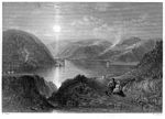
Black Law is a hill in the Manor Hills range, part of the Southern Uplands of Scotland. One of the more remote Donalds, it does not easily combine into a round with other hills in the area and requires traversing rough terrain to reach the top. Common ascents are as part of an extended Dun Rig Horseshoe to the north-east, from the south at the Megget Reservoir or, most easily, from the Manor Valley itself.

Excerpt from the Wikipedia article Black Law (hill) (License: CC BY-SA 3.0, Authors, Images).

Geographical coordinates (GPS)

Latitude Longitude
N 55.534422 ° E -3.239942 °
placeShow on map

Address

Scottish Borders


Scotland, United Kingdom
mapOpen on Google Maps

Black Law
Black Law
Share experience

Nearby Places

Megget
Megget

Megget is a former chapelry or parish containing the valley of Megget Water, now forming the westernmost part of the parish of Yarrow, Selkirkshire in the Scottish Borders area of Scotland. The centre of the valley is 19 miles (31 kilometres) west of Selkirk. The district is bordered on the west by the parish of Tweedsmuir, on the north-west by Drumelzier and on the north by Manor (all in Peeblesshire). On the east side it is joined to the rest of the present parish of Yarrow, but formerly the parish boundary with Yarrow ran southwards from Black Law to Deer Law to Cappercleuch burn thence to St. Mary's Loch and continued down the west shore of the loch for almost one mile (1.5 kilometres) to Mare Cleuch by the Rodono Hotel. It is bounded on the south by Ettrick in Selkirkshire and on the south-west by Moffat in Dumfriesshire. Megget Stone lies on the western parish boundary, with Tweedsmuir.It is about seven miles (eleven kilometres) long north to south and about six miles (ten kilometres) wide with an area of 14,500 acres (5,900 hectares).The population of Megget in 1861 was 53 and in 1901 was 73. At the latest census (in 2011) the population of Megget was around 50.The parish of Megget derived its name from the river Megget, which took its name from the whey colour of its waters (Gaelic or old Welsh). Until 1891 it was part of Peeblesshire and thus part of Tweeddale, however "the water of Meggit is the only water in Tweeddale, that pays no tribute to Tweed; but runs from the south-east, some five miles [8 km], and ends its course in the bosom of St Mary Loch, and from thence, with Yarrow, watereth the wοόdy banks of the Forrest" (namely Ettrick Forest – the county of Selkirkshire).

Southern Upland Way
Southern Upland Way

The Southern Upland Way is a 344-kilometre (214 mi) coast-to-coast long-distance footpath in southern Scotland. The route links Portpatrick in the west and Cockburnspath in the east via the hills of the Southern Uplands. The Way is designated as one of Scotland's Great Trails by NatureScot and is the longest of the 29 Great Trails. The Southern Upland Way meets with seven of the other Great Trails: the Annandale Way, the Berwickshire Coastal Path, the Borders Abbeys Way, the Cross Borders Drove Road, the Mull of Galloway Trail, the Romans and Reivers Route and St Cuthbert's Way.The path is maintained by the local authorities of the two main council areas through which it passes: Dumfries and Galloway Council and Scottish Borders Council; a short section in the Lowther Hills lies in South Lanarkshire. It is primarily intended for walkers, but many parts are suitable for mountain bikers; some sections are also suitable for horse riders. About 80,000 people use the path every year, of whom about 1,000 complete the entire route and a completion certificate can be applied for through the Southern Upland Way official website. It is considered the most difficult of Scotland's Great Trails but also one of the most rewarding to complete passing through some of the UK's most remote land. A popular and less challenging option is to walk it in two stages: typically Portpatrick to Moffat, then Moffat to Cockburnspath at a later date.