place

Borough of Burnley

1974 establishments in EnglandBoroughs in EnglandBurnleyEngvarB from April 2018Geographic coordinate lists
Incomplete lists from April 2019Lists of coordinatesLocal government in BurnleyNon-metropolitan districts of Lancashire
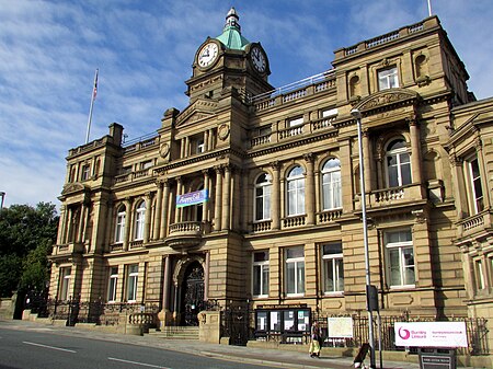
Burnley Town Hall 24997220736

The Borough of Burnley () is a local government district with the borough status in Lancashire, England. It has an area of 42.7 square miles (110.7 km2) and a population of 94,646 (2021), and is named after its largest town, Burnley. Other notable settlements include Padiham, Hapton, Worsthorne, Briercliffe and Cliviger. The borough is bounded by Hyndburn, Ribble Valley, Pendle, Rossendale – all in Lancashire – and the borough of Calderdale in West Yorkshire. It is governed by Burnley Borough Council, which is currently under no overall control following the 2019 local elections.

Excerpt from the Wikipedia article Borough of Burnley (License: CC BY-SA 3.0, Authors, Images).

Borough of Burnley
Manchester Road,

Geographical coordinates (GPS) Address Nearby Places
placeShow on map

Wikipedia: Borough of BurnleyContinue reading on Wikipedia

Geographical coordinates (GPS)

Latitude Longitude
N 53.787 ° E -2.245 °
placeShow on map

Address

Manchester Road

Manchester Road
BB11 1HJ , Burnley Wood
England, United Kingdom
mapOpen on Google Maps

Burnley Town Hall 24997220736
Share experience

Nearby Places

Burnley
Burnley

Burnley () is a town and the administrative centre of the wider Borough of Burnley in Lancashire, England, with a 2001 population of 73,021. It is 21 miles (34 km) north of Manchester and 20 miles (32 km) east of Preston, at the confluence of the River Calder and River Brun. The town is located near the countryside to the south and east, with the towns of Padiham and Brierfield to the west and north respectively. It has a reputation as a regional centre of excellence for the manufacturing and aerospace industries. The town began to develop in the early medieval period as a number of farming hamlets surrounded by manor houses and royal forests, and has held a market for more than 700 years. During the Industrial Revolution it became one of Lancashire's most prominent mill towns; at its peak, it was one of the world's largest producers of cotton cloth and a major centre of engineering. Burnley has retained a strong manufacturing sector, and has strong economic links with the cities of Manchester and Leeds, as well as neighbouring towns along the M65 corridor. In 2013, in recognition of its success, Burnley received an Enterprising Britain award from the UK Government, for being the "Most Enterprising Area in the UK". For the first time in more than fifty years, a direct train service now operates between the town's Manchester Road railway station and Manchester's Victoria station, via the newly restored Todmorden Curve, which opened in May 2015.