Morumbi, São Paulo

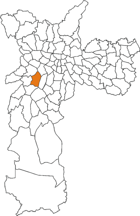
Morumbi (Brazilian Portuguese: [moɾũˈbi]) is a district of the city of São Paulo belonging to the subprefecture of Butantã, in the southwestern part of the city. A common folk etymology attributes its name to the mixed Portuguese and Tupi phrase morro obi, which would mean "green hill", but this is disputed. Morumbi is between 9 and 15 km (5.6 and 9.3 mi) away from São Paulo's downtown. It has boundaries with the districts of Vila Sônia, Campo Limpo, Vila Andrade, Itaim Bibi, Pinheiros, and Butantã. Within Morumbi, the neighborhoods of Vila Progredior, Caxingüi, Jardim Guedala, Cidade Jardim, Real Parque, Vila Morumbi, Paineiras do Morumbi, Jardim Panorama, Jardim Sílvia, Vila Tramontano and Paraisópolis are found.
Excerpt from the Wikipedia article Morumbi, São Paulo (License: CC BY-SA 3.0, Authors, Images).Morumbi, São Paulo
Rua Boytac, São Paulo Morumbi
Geographical coordinates (GPS) Address Nearby Places Show on map
Geographical coordinates (GPS)
| Latitude | Longitude |
|---|---|
| N -23.596188888889 ° | E -46.704344444444 ° |
Address
Rua Boytac
Rua Boytac
05502-001 São Paulo, Morumbi
São Paulo, Brazil
Open on Google Maps


