Mount Scopus
East JerusalemFormer exclavesGeography of JerusalemHills of IsraelLandforms of Jerusalem District ... and 2 more
Mount ScopusUse mdy dates from June 2013

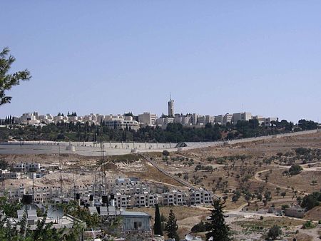
Mount Scopus (Hebrew: הַר הַצּוֹפִים Har HaTsofim, "Mount of the Watchmen/ Sentinels"; Arabic: جبل المشارف Ǧabal al-Mašārif, lit. "Mount Lookout", or جبل المشهد Ǧabal al-Mašhad "Mount of the Scene/Burial Site", or جبل الصوانة) is a mountain (elevation: 826 meters (2,710 ft) above sea level) in northeast Jerusalem. Between the 1948 Arab–Israeli War and the Six-Day War in 1967, the peak of Mount Scopus with the Hebrew University campus and Hadassah Hospital was a UN-protected Israeli exclave within Jordanian-administered territory. Today, Mount Scopus lies within the municipal boundaries of the city of Jerusalem.
Excerpt from the Wikipedia article Mount Scopus (License: CC BY-SA 3.0, Authors, Images).Mount Scopus
Reagan Plaza, Jerusalem Mount Scopus
Geographical coordinates (GPS) Address Nearby Places Show on map
Geographical coordinates (GPS)
| Latitude | Longitude |
|---|---|
| N 31.7925 ° | E 35.244166666667 ° |
Address
האוניברסיטה העברית - הר הצופים
Reagan Plaza
9711769 Jerusalem, Mount Scopus
Jerusalem District, Israel
Open on Google Maps


