place

The Palisades (Hudson River)

Cliffs of the United StatesHudson RiverLandforms of Bergen County, New JerseyLandforms of Hudson County, New JerseyLandforms of New Jersey
Landforms of New York (state)Landforms of Rockland County, New YorkNational Natural Landmarks in New JerseyNational Natural Landmarks in New York (state)Palisades Interstate Park systemRegions of New JerseyUse mdy dates from June 2018
Hudson River Palisades seen from 187th Street crop

The Palisades, also called the New Jersey Palisades or the Hudson River Palisades, are a line of steep cliffs along the west side of the lower Hudson River in Northeastern New Jersey and Southeastern New York in the United States. The cliffs stretch north from Jersey City about 20 miles (32 km) to near Nyack, New York, and visible at Haverstraw, New York. They rise nearly vertically from near the edge of the river, and are about 300 feet (90 m) high at Weehawken, increasing gradually to 540 feet (160 m) high near their northern terminus. North of Fort Lee, the Palisades are part of Palisades Interstate Park and are a National Natural Landmark.The Palisades are among the most dramatic geologic features in the vicinity of New York City, forming a canyon of the Hudson north of the George Washington Bridge, as well as providing a vista of the Manhattan skyline. They sit in the Newark Basin, a rift basin located mostly in New Jersey. Palisade is derived from the same root as the word pole, ultimately from the Latin word palus, meaning stake. A "palisade" is, in general, a defensive fence or wall made up of wooden stakes or tree trunks. The Lenape called the cliffs "rocks that look like rows of trees", a phrase that became "Weehawken", the name of a town in New Jersey that sits at the top of the cliffs across from Midtown Manhattan.

Excerpt from the Wikipedia article The Palisades (Hudson River) (License: CC BY-SA 3.0, Authors, Images).

The Palisades (Hudson River)
Long Path,

Geographical coordinates (GPS) Address Nearby Places
placeShow on map

Wikipedia: The Palisades (Hudson River)Continue reading on Wikipedia

Geographical coordinates (GPS)

Latitude Longitude
N 40.96451 ° E -73.90859 °
placeShow on map

Address

Long Path

Long Path
07620
New Jersey, United States
mapOpen on Google Maps

Hudson River Palisades seen from 187th Street crop
Share experience

Nearby Places

Alpine, New Jersey
Alpine, New Jersey

Alpine is a borough in Bergen County, New Jersey, United States, approximately 15 miles (24 km) north of Midtown Manhattan. It is the easternmost community in the State of New Jersey. As of the 2010 United States Census, the borough's population was 1,849, reflecting a decline of 334 (−15.3%) from the 2,183 counted in the 2000 Census, which had in turn increased by 467 (+27.2%) from the 1,716 counted in the 1990 Census.In 2012, Forbes ranked Alpine as America's most expensive ZIP Code with a median home price of $4.25 million, after being ranked 4th in the magazine's 2010 listing of "America's Most Expensive ZIP Codes", with a median home price of $3,814,885. In 2009, Forbes ranked Alpine first, along with Greenwich, Connecticut, with a median home price of $4.14 million. Alpine was tied with Greenwich for first in both 2006 and 2007 on the ABC News list of most expensive ZIP Codes, with a median home sale price of $3.4 million. In 2019, PropertyShark ranked Alpine as the 53rd most expensive ZIP Code in the country with a median sales price of $1,785,000, a drop from a ranking of 33rd nationwide in 2018 due to a decline of 19% in sales prices. Based on data from the 2006-2010 American Community Survey, the borough had a per-capita income of $107,604, ranked second in the state.New Jersey Monthly magazine ranked Alpine as its 15th best place to live in its 2008 rankings of the "Best Places To Live" in New Jersey.Alpine was formed by an act of the New Jersey Legislature on April 8, 1903, from portions of Harrington Township. The borough acquired a portion of Cresskill in 1904. The borough's name came from the wife of journalist Charles Nordhoff, who found the setting reminiscent of the Swiss Alps.

Armstrong Tower
Armstrong Tower

The Armstrong Tower, also known as Alpine Tower, is a distinctive 129.5 meter (425 foot) tall lattice tower featuring three large cross-arms, located atop the Alpine, New Jersey palisades overlooking the Hudson River a few kilometers north of New York City at 40°57'39.0" N and 73°55'21.0" W (40.9607 -73.9225). It is owned by Alpine Tower Company and managed by CSC Management, LLC, both owned by Charles E. Sackermann, Jr.The tower is the permanent transmitter site for locally based experimental station WA2XMN and Fairleigh Dickinson University's educational FM station WFDU, in additional to numerous directional radio services (including as a cell site). It is clearly visible from across the Hudson River and is used as a Visual flight rules waypoint by aircraft flying within the New York City Special flight rules area.The tower was originally constructed by inventor Edwin Howard Armstrong in 1938 for developmental activities that led to modern FM radio. The original transmissions (W2XMN) occurred at 42.8 MHz. At the tower base is a building originally used for research by Armstrong, which still has the W2XMN call sign engraved above its main entrance. This building currently houses the Armstrong Field Laboratory, and serves as a museum containing artifacts from the development of FM radio technology.The structure was also used as a temporary transmitter site for some of New York City's television stations after the collapse of the World Trade Center, including its transmitting antenna, during the September 11, 2001 attacks.

Glenview Mansion
Glenview Mansion

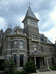
Glenview Mansion, listed on the National Register of Historic Places as the John Bond Trevor House, is located on Warburton Avenue in Yonkers, New York, United States. It is a stone house erected during the 1870s in an eclectic Late Victorian architectural style from a design by Charles W. Clinton. It was listed on the Register in 1972. It is one of the few remaining buildings in Yonkers made of locally quarried greystone. Inside there is fine Eastlake cabinetry by the prominent Philadelphia cabinetmaker Daniel Pabst and other decorations and finishes; it is considered one of the finest interiors in that style in an American building open to the public.Financier John Bond Trevor built the house as a small country estate that was nevertheless close enough to New York City to allow him to commute to his job in the city by rail. At the time he and his family moved in, it was surrounded by similar houses. By the time Trevor's second wife died in the early 1920s, Glenview had become the center of a suburban neighborhood. The design of the house and the way the Trevors lived there epitomizes the transition between country living and the modern suburb. In 1929, after the Trevor family had moved out, the house became home to the Hudson River Museum for the next 45 years. The museum has since expanded but the house remains part of the complex. Its rooms have been refurbished in the style of the period, and are open to visitors. Renovations in the early 21st century have better integrated the house with the rest of the museum.

Untermyer Park and Gardens

Untermyer Park and Gardens is a historic 43-acre (17 ha) city public park, located in Yonkers, New York in Westchester County, just north of New York City. The park is a remnant of Samuel Untermyer's 150-acre (61 ha) estate "Greystone". Situated on the steep land arising from the eastern bank of the Hudson River to the bluff on top of it, the park features a Walled Garden inspired by ancient Indo-Persian gardens, a small Grecian-style open-air amphitheater with two facing sphynxes supported by tall Ionic columns, a classical pavilion, stoa and loggias, a rock-and-water feature called "The Temple of Love", as well as a long staircase from the Walled Garden to an Overlook with views of the river and the Palisades. The gardens were developed beginning in 1916 by Untermyer, a prominent lawyer and civic leader, and were designed by architect and landscape designer William W. Bosworth, with fountains by Charles Wellford Leavitt, and sculptures by Paul Manship and other artists. The gardens were regularly opened to the public, hosted performances of noted dancers, actors and musicians, and were considered to be among the finest gardens in the United States. When Untermyer died in 1940, he had hoped to donate the whole estate to the United States, or the State of New York, or at least to the City of Yonkers. Eventually Yonkers agreed to accept part of the estate. The parcel, which was the core of the gardens, and which has been added to since that time, was renamed Untermyer Park and Gardens in his honor. It was added to the National Register of Historic Places in 1974.Untermyer Gardens have recently undergone a significant campaign of restorations, which is continuing.