place

Kilsyth Victoria Cottage Hospital

1903 establishments in ScotlandHospital buildings completed in 1903Hospitals established in 1903Hospitals in North LanarkshireNHS Lanarkshire
NHS Scotland hospitalsScottish building and structure stubsUnited Kingdom hospital stubs

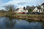
Kilsyth Victoria Cottage Hospital is a health facility in Glasgow Road, Kilsyth, North Lanarkshire, Scotland. It is managed by NHS Lanarkshire.

Excerpt from the Wikipedia article Kilsyth Victoria Cottage Hospital (License: CC BY-SA 3.0, Authors).

Kilsyth Victoria Cottage Hospital
Victoria Park,

Geographical coordinates (GPS) Address Nearby Places
placeShow on map

Wikipedia: Kilsyth Victoria Cottage HospitalContinue reading on Wikipedia

Geographical coordinates (GPS)

Latitude Longitude
N 55.9767 ° E -4.0701 °
placeShow on map

Address

Victoria Memorial Cottage Hospital

Victoria Park
G65 9AG , Westfield
Scotland, United Kingdom
mapOpen on Google Maps

Share experience

Nearby Places

Antonine Wall
Antonine Wall

The Antonine Wall (Latin: Vallum Antonini) was a turf fortification on stone foundations, built by the Romans across what is now the Central Belt of Scotland, between the Firth of Clyde and the Firth of Forth. Built some twenty years after Hadrian's Wall to the south, and intended to supersede it, while it was garrisoned it was the northernmost frontier barrier of the Roman Empire. It spanned approximately 63 kilometres (39 miles) and was about 3 metres (10 feet) high and 5 metres (16 feet) wide. Lidar scans have been carried out to establish the length of the wall and the Roman distance units used. Security was bolstered by a deep ditch on the northern side. It is thought that there was a wooden palisade on top of the turf. The barrier was the second of two "great walls" created by the Romans in Great Britain in the second century AD. Its ruins are less evident than those of the better-known and longer Hadrian's Wall to the south, primarily because the turf and wood wall has largely weathered away, unlike its stone-built southern predecessor. Construction began in 142 AD at the order of Roman Emperor Antoninus Pius. Estimates of when it was completed vary widely, with six and twelve years most commonly proposed. Antoninus Pius never visited Britain, unlike his predecessor Hadrian. Pressure from the Caledonians probably led Antoninus to send the empire's troops further north. The Antonine Wall was protected by 16 forts with small fortlets between them; troop movement was facilitated by a road linking all the sites known as the Military Way. The soldiers who built the wall commemorated the construction and their struggles with the Caledonians with decorative slabs, twenty of which survive. The wall was abandoned only eight years after completion, and the garrisons relocated rearward to Hadrian's Wall. Most of the wall and its associated fortifications have been destroyed over time, but some remains are visible. Many of these have come under the care of Historic Environment Scotland and the UNESCO World Heritage Committee.

Bar Hill Fort
Bar Hill Fort

Bar Hill Fort was a Roman fort on the Antonine Wall in Scotland. It was built around the year 142 A.D.. Older maps and documents sometimes spell the name as Barr Hill. A computer generated fly around for the site has been produced. Lidar scans have been done along the length of the wall including Bar Hill. Sir George Macdonald wrote about the excavation of the site. Many other artefacts have also been found at Shirva, about a mile away on the other side of Twechar.Many Roman forts along the wall held garrisons of around 500 men. Larger forts like Castlecary and Birrens had a nominal cohort of 1000 men but probably sheltered women and children as well although the troops were not allowed to marry. There is likely too to have been large communities of civilians around the site.An altar (RIB 2167) to Silvanus was found in 1895 on Bar Hill. It's thought to have originated from a small shrine outside the fort. The altar is now kept in the Hunterian Museum, Glasgow along with others like the one found at Castlecary. A 43 foot deep well was discovered at the site. Several item were recovered from the well. It's possible they were dumped there when the site was abandoned. Shoes from men, women and children were found leading to suggestions of family life. Other recovered items include an altar, bones, shells and coins. Structural materials like building columns, wooden beams were found as was part of the pulley of the well. Videos of some reconstructed objects like a barrel, a window. and various columns have been produced as well as one of a bust of Silenus.Bar Hill Fort was one of over a dozen forts built along the Antonine Wall from around 140 AD. These follow a short route across Scotland’s central belt which was largely followed in the 18th century when constructing the Forth and Clyde canal. On the south-facing slope of the hill is the headquarters; it is the biggest building that can be seen. The remains of a Roman bathhouse can also be observed.

Colzium
Colzium

Colzium House and Estate (pronounced Coal-Zee-Um) is about 500 metres to the north-east of Kilsyth, North Lanarkshire, Scotland. The present house dates from 1783 and was extended and modernised in 1861. The name may mean "defile leap".W Mackay Lennox bought Colzium House and its policies in 1930 and in 1937, on his retiral as Town Clerk, he presented them to Kilsyth Burgh, in memory of his mother. The house and estate are principally used for public recreation, as the venue for the annual Kilsyth International Carnival in mid August, an "Italian Picnic" – a gathering of Italian/Scottish families, and functions such as weddings and parties. There is also a fine walled garden and a small theatre, the "clock theatre". A children's adventure playground has been opened. The estate still contains the ruins of Colzium Castle just 100 metres north of Colzium House at the point where the driveway turns sharp left to Tak-Ma-Doon Road. The first building here was a large L-plan castle built by the Livingstons of Callendar in the mid-15th century to replace the ancient motte. A substantial hall block was added in 1575. The castle was demolished by the 3rd Viscount of Kilsyth in 1703, immediately prior to his accession to the title. The family lost the estate due to their Jacobite sympathies, and it then became the property of the Edmonstone family from Duntreath.There is an ice house c. 1680 in the glen of the Colzium Burn which was excavated in 1977 and may still be viewed. The estate also contains the oldest curling ponds in the world. Kilsyth Curling Club, the world's first recorded curling club, was founded in Kilsyth in 1716. The Battle of Kilsyth (1645) in the Wars of the Three Kingdoms was fought just a kilometre to the east. A ring, supposed to be the one lost by Lady Kilsyth, was reported to be kept at the house.