Salcombe Cannon Wreck

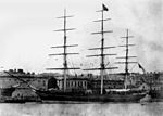
The Salcombe Cannon wrecksite is close to two other designated wrecksites in the Erme Estuary which the South West Maritime Archaeological Group (SWMAG) was licensed to investigate. In 1992 this group described the Salcombe Cannon site as: "A cannon site with nothing else visible".In 1994, following seabed changes, other artifacts including gold were revealed and the SWMAG began recording the site. Coins and jewellery dating between 1510 and 1636 have been recovered from the site and were purchased by the British Museum in 1998. For two seasons information about the site was initially kept confidential between the Receiver of Wreck, the finders and the Archaeological Diving Unit (working for the Advisory Committee on Historic Wreck). The site was designated under the Protection of Wrecks Act in 1997 when news about it was made public. The wreck is a Protected Wreck managed by Historic England. The vessel is unknown but is dated between 1630 and 1640, and it has yielded the largest ever find of Moroccan gold in Europe.The site has been surveyed and recorded using traditional survey methods, magnetometer, multi-beam sonar and photo-mosaic.
Excerpt from the Wikipedia article Salcombe Cannon Wreck (License: CC BY-SA 3.0, Authors, Images).Salcombe Cannon Wreck
Woodlane, South Hams East Portlemouth
Geographical coordinates (GPS) Address Nearby Places Show on map
Geographical coordinates (GPS)
| Latitude | Longitude |
|---|---|
| N 50.213288 ° | E -3.738951 ° |
Address
Bronze Age Field System
Woodlane
TQ7 2RR South Hams, East Portlemouth
England, United Kingdom
Open on Google Maps


