Scafells
Calderas of EnglandFells of the Lake DistrictOrdovician volcanoesVEI-7 volcanoes

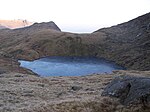
The Scafells, or Scafell Massif, are range of fells in the Cumbrian Mountains of England, made up of the remains of a caldera volcano. Fells in the range include Scafell, England's tallest mountain Scafell Pike, Broad Crag and Ill Crag. Great End, Lingmell and Slight Side are also usually included within the definition. These hills form part of the Southern Fells.
Excerpt from the Wikipedia article Scafells (License: CC BY-SA 3.0, Authors, Images).Scafells
Geographical coordinates (GPS) Address Nearby Places Show on map
Geographical coordinates (GPS)
| Latitude | Longitude |
|---|---|
| N 54.471 ° | E -3.144 ° |
Address
Birch How
CA12 5XG
England, United Kingdom
Open on Google Maps


