place

Special Hillsides Preservation District

North Shore, Staten IslandProtected areas of Staten Island
Special Hillside Preservation District NYC Map

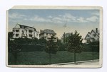
The Special Hillsides Preservation District was created in 1987 by the City of New York to preserve the hilly terrains of the North Shore of Staten Island. The district maintains different planning rules to the rest of the City to account for the geological and bio diversity of the area. The district's goals are to reduce hillside erosion, landslides, and excessive storm-water runoff by conserving vegetation and protecting natural terrain; preserve hillsides with unique aesthetic value; protect areas of outstanding natural beauty; and protect neighborhood character.The district is under the Staten Island Community Board 1 supervision and it affects the green areas in the following Staten Island neighborhoods: Grymes Hill, New Brighton, Randall Manor, Silver Lake, St. George, Tompkinsville, Ward Hill, and West Brighton. There have been current debates on whether the new proposed rules announced in 2019 by NYC's Department of City Planning (DCP) meant to establish clear rules for home construction projects, will actually weaken the environmental protection goals of the preservation districts, as they will remove opportunities for public input on proposed developments in their neighborhood.

Excerpt from the Wikipedia article Special Hillsides Preservation District (License: CC BY-SA 3.0, Authors, Images).

Special Hillsides Preservation District
Cow Path, New York Richmond County

Geographical coordinates (GPS) Address Nearby Places
placeShow on map

Wikipedia: Special Hillsides Preservation DistrictContinue reading on Wikipedia

Geographical coordinates (GPS)

Latitude Longitude
N 40.62345 ° E -74.08691 °
placeShow on map

Address

Cow Path

Cow Path
10301 New York, Richmond County
New York, United States
mapOpen on Google Maps

Special Hillside Preservation District NYC Map
Share experience

Nearby Places

Staten Island Serpentinite

The Staten Island Serpentinite locality is a southward extension of the New England Uplands, adjacent to the Manhattan Prong. It includes Todt Hill on Staten Island, which is the highest point along the Atlantic Seaboard south of Maine, at 410 feet (120 m) above sea level. "Todt" is a Dutch word meaning "dead." This hill perhaps received its name from the Dutch settlers because the hilltops overlooking The Narrows consisted of scattered treeless rocky exposures. The chemical character of the bedrock was, in part, the reason for this. Much of Staten Island is covered by the Harbor Hill moraine, the terminal moraine of the last Wisconsin Stage glacier. However, ledges of bedrock consisting of serpentinite are exposed throughout the upland areas on Staten Island. Grymes Hill, the second highest point on Staten Island and just a few miles from Todt Hill has similar bedrock characteristics. Serpentine, the dominant mineral in serpentinite, is rich in magnesium, an element that most plants cannot tolerate in high concentrations. The enrichment of magnesium in the thin serpentine soil covering the glacier-scoured hilltops is probably responsible for the original barren exposures on Todt Hill. The serpentinite has a bluish to greenish gray color, and consists of serpentine (mostly the variety antigorite), with accessory minerals of chrysotile (a form of asbestos), magnetite, and talc. Serpentinite is derived by the metamorphism of ultramafic rocks (rocks rich in the minerals olivine and pyroxene) in a water-rich environment. The probable original setting for these rocks was within the igneous crust beneath the Iapetus Ocean. The occurrence of serpentinite in the core of Staten Island is an indication that the allochthonous basement rocks consisting of oceanic crustal material were thrust landward onto the eastern margin of the continent during the Taconic orogeny. The occurrence of serpentinite is consistent with the interpretation that Staten Island is east of Cameron's Line. This article incorporates public domain material from Staten Island Serpentinite. United States Geological Survey.