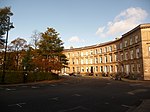
Kelvingrove, Glasgow
Areas of Glasgow

Kelvingrove is a neighbourhood in the city of Glasgow, Scotland. It is situated north of the River Clyde in the West End of the city, and directly borders Kelvingrove Park to the north and the grounds of the Kelvingrove Art Gallery and Museum to the west. Its other boundaries are not precisely defined, but roughly correspond to Sauchiehall Street to the south opposite the Sandyford neighbourhood, and the Charing Cross area to the east.
Excerpt from the Wikipedia article Kelvingrove, Glasgow (License: CC BY-SA 3.0, Authors, Images).Kelvingrove, Glasgow
Royal Terrace Lane, Glasgow Kelvingrove
Geographical coordinates (GPS) Address Nearby Places Show on map
Geographical coordinates (GPS)
| Latitude | Longitude |
|---|---|
| N 55.866133 ° | E -4.283775 ° |
Address
Royal Terrace Lane
Royal Terrace Lane
G3 7PA Glasgow, Kelvingrove
Scotland, United Kingdom
Open on Google Maps


