place

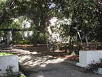
Governor Stoneman Adobe, Los Robles
1876 establishments in CaliforniaCalifornia Historical LandmarksSan Marino, CaliforniaVague or ambiguous time from August 2022
0669CHSGovernorStonemanAdobeLosRobles

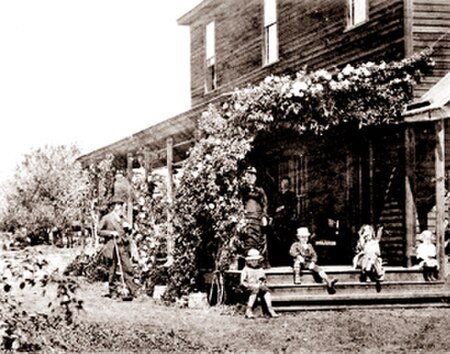
Governor Stoneman Adobe, Los Robles was the home of George Stoneman, the 15th Governor of California, from January 10, 1883, to January 8, 1887. The home was built in 1876 on his 400-acre estate, that was on the former Rancho San Pascual, present-day San Marino, California,. The location was designated a California Historic Landmark (No. 669) on December 1, 1958. Nothing remains of the home as it was destroyed in a fire, which was rumored to have been started by one of his political enemies. George Stoneman was a general in the Union Army in the American Civil War, who led the last cavalry raid of the war. After the war, Stoneman moved to California, the place of which he had dreamed since his service as a young officer before the war. He and his wife settled in the San Gabriel Valley on a 400-acre (160 ha) estate called Los Robles. He was appointed as a state railroad commissioner, serving from 1876 to 1878. In 1882, Stoneman was elected governor of California as a Democrat and served a single four-year term. He was not renominated by his party for a second term. After his house burned down, he was broken financially by the disaster and was in poor health. He returned to New York State for medical treatment. He died following a stroke in Buffalo, New York, on September 5, 1894, at age 72. He is buried in the Bentley Cemetery in Lakewood, New York.

Excerpt from the Wikipedia article Governor Stoneman Adobe, Los Robles (License: CC BY-SA 3.0, Authors, Images).

Governor Stoneman Adobe, Los Robles
Montrobles Place,

Geographical coordinates (GPS) Address Nearby Places
placeShow on map

Wikipedia: Governor Stoneman Adobe, Los RoblesContinue reading on Wikipedia

Geographical coordinates (GPS)

Latitude Longitude
N 34.114252 ° E -118.136196 °
placeShow on map

Address

Montrobles Place 1938
91030
California, United States
mapOpen on Google Maps

0669CHSGovernorStonemanAdobeLosRobles
Share experience

Nearby Places

Beverly Glen Boulevard

Beverly Glen Boulevard is one of six major routes that connect the Westside of Los Angeles to the San Fernando Valley (the other five are the San Diego (405) Freeway, Sepulveda Boulevard, Topanga Canyon Boulevard, Laurel Canyon Boulevard, and Coldwater Canyon Avenue. It starts at Rancho Park Golf Course on Pico Boulevard in West Los Angeles. It proceeds to intersect with Santa Monica and Wilshire boulevards, passing near Century City, Sinai Temple and Los Angeles Country Club. The road marks the eastern border of the Westwood Prosperity Unit development built by Janss Investment Company as the foundation of the Westwood neighborhood of Los Angeles. As the road travels further north, it intersects with Sunset Boulevard near UCLA and passes the gated communities of Bel Air and the middle school campus of the Harvard-Westlake School. The hills through which the boulevard passes north of Sunset and south of Mulholland Drive is known as Beverly Glen. Beverly Glen runs parallel to the wealthy section of Bel-Air and its gated communities. The housing development at Beverly Glen and Mulholland was laid out in the 1950s and was originally known as Glen-Aire. After passing Mulholland, Beverly Glen Boulevard swerves west and passes through the exclusive hillside homes in Sherman Oaks. "Stilt Street" is a row of twenty stilt houses designed by architect Richard Neutra that perch on the steep hillside above the boulevard. The road ends at Ventura Boulevard in the south end of the Valley. Commuters seeking to go further north into the Valley go one block west to Van Nuys Boulevard which spans most of the Valley's length. Beverly Glen Boulevard is east of Sepulveda Boulevard and the San Diego Freeway (I-405). When traffic on I-405 becomes unbearable, many commuters take Beverly Glen or Sepulveda instead, causing considerable congestion on both streets.