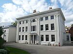
Soho, West Midlands

Soho is an area that is in Central Birmingham and Smethwick, approximately 2 miles north west of Birmingham city centre on the A41. The name is an abbreviation of South House, denoting that it was located to the south of Handsworth. The section of the A41 separating Handsworth from Winson Green is known as Soho Road. Soho expanded dramatically during the 19th century with the construction of numerous houses and factories, and immigration from the Commonwealth was centred in these homes during the 1950s and 1960s. Most of the immigrants who settled in Soho were of Indian origin. Further housebuilding took place by the local council during the 1960s and 1970s. Soho falls partly in the Soho ward of the City of Birmingham and partly in the Soho and Victoria ward of the Borough of Sandwell.
Excerpt from the Wikipedia article Soho, West Midlands (License: CC BY-SA 3.0, Authors, Images).Soho, West Midlands
Newton Place, Birmingham Winson Green
Geographical coordinates (GPS) Address Nearby Places Show on map
Geographical coordinates (GPS)
| Latitude | Longitude |
|---|---|
| N 52.4991 ° | E -1.9288 ° |
Address
Newton Place 29
B18 5JY Birmingham, Winson Green
England, United Kingdom
Open on Google Maps


