Águas Livres (Amadora)
Parishes of AmadoraPortugal geography stubs
Águas Livres is a Portuguese urban civil parish (freguesia) in the municipality of Amadora. The population in 2011 was 37,426. It was created in 2011, incorporating most of the area from the former parishes of Buraca, Damaia, and Reboleira. It is bordered by the parishes of Alfragide, to the south, Falagueira – Venda Nova, to the north, Venteira to the west and Benfica to the east. It takes its name from the most significant landmark in its territory, the Águas Livres Aqueduct.
Excerpt from the Wikipedia article Águas Livres (Amadora) (License: CC BY-SA 3.0, Authors).Águas Livres (Amadora)
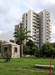
Rua do Moinho, Águas Livres Damaia
Geographical coordinates (GPS) Address Nearby Places Show on map
Geographical coordinates (GPS)
| Latitude | Longitude |
|---|---|
| N 38.744622 ° | E -9.215091 ° |
Address
Rua do Moinho
Rua do Moinho
2610-301 Águas Livres, Damaia
Portugal
Open on Google Maps


