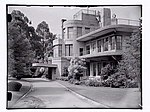
Olinda, Victoria
Logging communitiesLogging in AustraliaSuburbs of MelbourneSuburbs of Yarra RangesTowns in Victoria (state) ... and 1 more
Use Australian English from August 2019

Olinda is a town within the Dandenong Ranges in central-south Victoria, Australia, located 41 km (25 mi) east of Melbourne's CBD, located within the Shire of Yarra Ranges local government area. Olinda recorded a population of 1,773 at the 2021 census.It is a popular weekend destination for tourists, with a variety of restaurants and cafes. The town is home to the Dandenong Ranges Botanic Garden and R.J. Hamer Arboretum.
Excerpt from the Wikipedia article Olinda, Victoria (License: CC BY-SA 3.0, Authors, Images).Olinda, Victoria
Mount Dandenong Tourist Road, Melbourne Olinda
Geographical coordinates (GPS) Address Nearby Places Show on map
Geographical coordinates (GPS)
| Latitude | Longitude |
|---|---|
| N -37.85599 ° | E 145.364357 ° |
Address
Mount Dandenong Tourist Road 551
3788 Melbourne, Olinda
Victoria, Australia
Open on Google Maps


